
Yeonhwa-do 연화도
212.2 meters
9 km return
📍trailhead
I had heard mention of Yeonhwa-do once in the past, but it had mostly been off my radar as a good spot for hiking, or simply an interesting day-trip from Geoje. After spending a sunny day in January hiking the island with Andrew, I can’t sing its praises enough. Read on for a taste of the beauty offered on Yeonhwa-do and the details to plan your own island hiking excursion.
To get to Yeonhwa-do, you can catch a ferry from the Tongyeong Port Ferry Terminal 통영항 여객선 터미널 along the waterfront in Tongyeong. We caught the 9:50am ferry going to the island and returned on the last ferry of the day returning to Tongyeong at 5:15. The ferry tickets were 11,600won in each direction. The price and times may change in the future, but this is the current information as of January 2020.
Sidenote: The tourist hotline number: 1330, is a great resource when wanting to double check information that you’ve found online that may be outdated.
The sign pictured below shows the information for Yeonhwa-do in the center box: left side is departing Tongyeong, and right side departing Yeonhwa-do. The ferry itself will also stop at Yokji-do (another great island for a day trip) after dropping off the Yeonhwa-do passengers, so don’t panic if others don’t get off the ferry when you do. It’s approximately a one hour ferry ride to Yeonhwa-do.

We had arrived quite early to the terminal so we had a quick bite while waiting for our ferry. I was excited to have some chungmu gimbap, Tongyeong’s specialty, before hopping on the ferry.


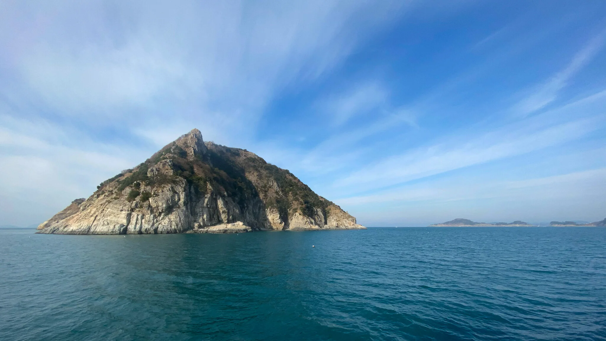
Once on the ferry, it is floor style seating with a few benches along the walls. We were among the first people to board and were lucky to get a bench, but I eventually migrated to the floor to spread out like the other passengers. Although we mostly played Terraforming Mars (app) for the trip, we couldn’t help but notice some pretty looking islands along the way.

Once on the island, you can pick your route. On our trip, most people were following the A course, which is the hiking route. We took the A course to the other end of the island and returned by following the B Course. After the main peak, much of the route runs side by side, with the main difference being that the A course is mostly hiking, and the B course follows a roadway.
Naver maps doesn’t show the trails for this particular island, but the map on the brochure pictured below gives a good overview. The orange line is the hiking portion ( A course), while yellow follows a narrow roadway (B Course).

Once on land, you’ll see the large arrows pointing for each course direction painted on the roadway. Follow the arrow pointing to the right and walk until you reach the trailhead at the corner of the bay.


Starting out it will be a 1.3 kilometer climb to the peak. It’s a bit of a steep climb, but you don’t have far to go, After a while, you’ll reach the ridge-line where you’ll have an open view looking towards Yokji-do, a neighboring island that is also a great day-trip destination. In the near distance, you’ll also be able to see the standing Buddha which is located on the peak.
Continue along the trail and before you know it you’ll have reached the peak. Here, you’ll get a great view of the rest of the island. You can see Yongmeori, also known as the “dragon’s head”. This is the tip of the island which has beautiful rocky cliffs that jut into the ocean below. It looks more like a dragon’s tail than a head to me, but apparently it’s supposed to resemble a dragon who is taking a swim in the ocean, with it’s head slightly immersed in the water.

Be sure to get a photo at the summit stone, marvel at the standing Buddha, and have a snack in the gazebo overlooking the ocean before continuing on the trail.


Take the stairs that run next to the gazebo, and follow the roadway down the hill. You’ll pass by a few small temple buildings on the left. Soon you’ll reach a junction. Turn right and go down the steep hill to reach Bodeokam, the 5-story temple that is nestled into the rocky cliff well above the ocean. You’ll approach the temple from the back, but you can follow a steep walkway on the right of the temple to get a view of it in its entirety.


Next, return up the steep hill that you just walked down and when you reach the junction where you had turned off, make a right to get back on the trail. Quickly, you’ll come upon a 5-story pagoda and a few picnic tables along the trail with more stunning views of the ocean.


This short stretch of trail will be easy going, with an old wooden fence hugging the trail in parts. Continue along and after about ten minutes you’ll emerge back on the roadway.
Follow the roadway another short distance, being sure to look back to catch a glimpse of the 5-story temple as it appears above the ocean cliffs. After about 5 minutes, the next section of trail will once again appear on the right.
Back on the trail, you’ll see a short offshoot along the way, leading to a rotting wooden rest platform.
After about 15 minutes, the excitement will start to build as you get closer to Yongmeori. You’ll see plenty of small off-shoots to the edges of the rocky cliffs. They aren’t for the faint of heart as there is no safety railings at these off-shoots, but they once again offer some amazing views.


Can you spot the 5-story temple way in the distance?


Can you see the suspension bridge below?
Finally, you’ll be climbing along the dragon’s back and approaching the suspension bridge, 출렁다리, that carries you over the cliffs and closer to the dragon’s head.

Soon after crossing the bridge, the trail will soften a little as you walk along the open grassy ridge-line. You’ll pass a turn-off along the way, but keep going straight. This will lead you to the final look-off wooden platform.


When you’ve had your fill of the views you can turn back. We opted to follow the roadway to see some different views, but be prepared, as parts of it are still quite steep. However, it allows you to walk through the little village that is at the end of the trail. To get back on the roadway, make a right at the off-shoot you passed with the black arrow pointing towards the village.

You’ll come out onto a rocky beach that is behind the village. Go down on the beach and there is a concrete staircase that will take you up. You’ll see a trail leading up the grassy hill across from you, but unfortunately we didn’t have time this visit to keep further exploring. Pass through the small village and start climbing the steep roadway ahead.

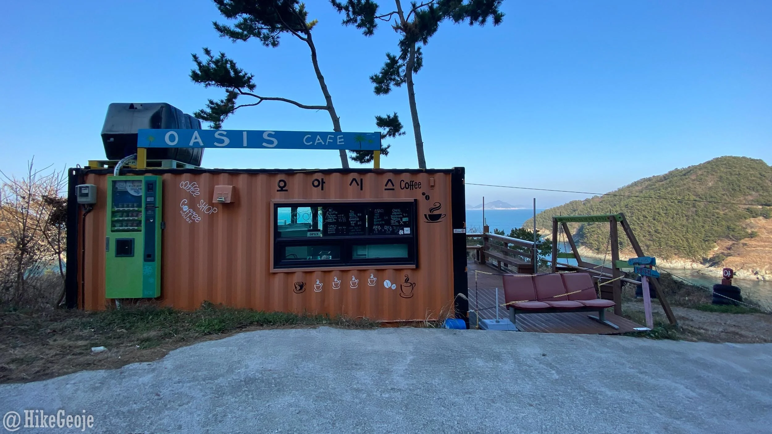
At the top of the hill there is a cute shipping container cafe that looks like it would have been a great spot for a coffee, but unfortunately it was closed during our visit.
Continue along the road heading back towards the ferry terminal. Eventually, you’ll reach a junction where you can turn left to go back towards the large standing Buddha or continue to the right for a short-cut back to the terminal and another large temple area. We chose to continue to the right.

We passed a beautiful looking temple along the way, Yeonhwasa, but chose to continue on as our ferry time was approaching and we wanted a chance to check out the bridges to Banha-do and U-do Islands.
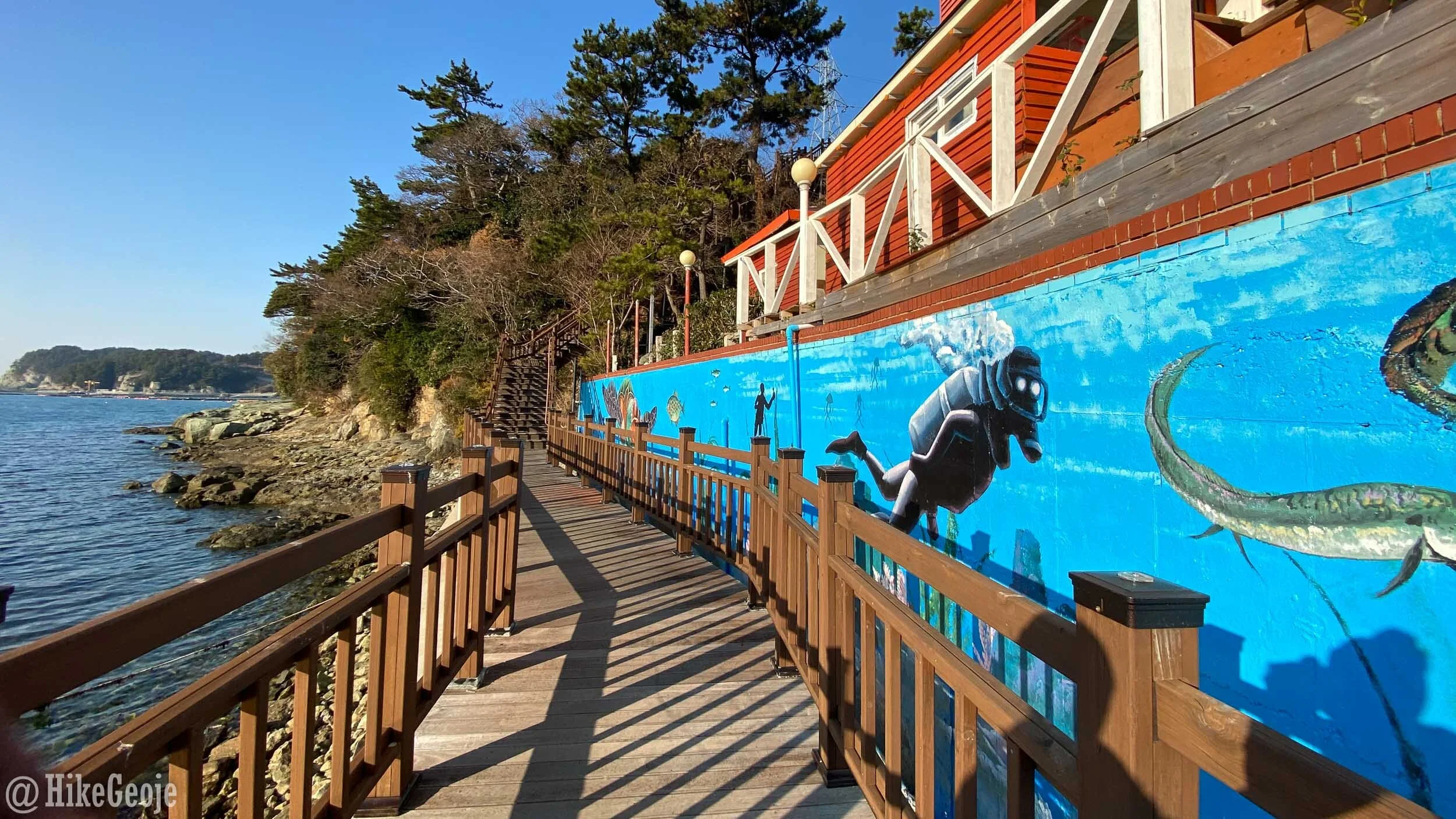
Back at the village, there are some absolutely beautiful murals painted along the walls.

If you have time, keep going straight where you first arrived and then follow the wooden walkway to the left (if you are facing the cafe) passing the scuba diving mural.
Climb a steep set of stairs and this will lead you to the newly constructed bridge to Banha-do.

Once you’ve crossed the bridge, you can follow the wooden walkway for another short distance to reach one more bridge to cross to get to U-do. Unfortunately for us, our ferry was quickly approaching so we didn’t get to fully explore this island.

Looking back at Banha-do
Instead we headed back to the port area to get a coffee at (what we dubbed) the pirate cafe. Inside we got to meet a 19 year-old dog with his own reserved sofa and radiator and relax for a few minutes before our departure. I really recommend the sweet potato latte here, it was delicious!


It was a long, somewhat cold day, but we had an amazing visit! I’ll be back, Yeonhwa-do!
