

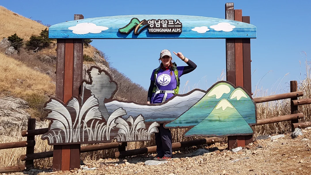
Yeongnam Alps 영남알프스
ganwoljae 간월재 900 meters
ganwolsan 간월산 1069 meters
Sinbulsan 신불산 1159 meters
yeongchuksan 영축산 1081 meters
Approximately 17km thru-hike
📍trailhead
I first spotted the Yeongnam Alps a few years ago while passing through Ulsan on a road trip. My curiosity had me checking the map to see the info on these mountains. Soon enough I learned about the Yeongnam Alps, in particular, Sinbulsan which is famous for its silver grass in fall.
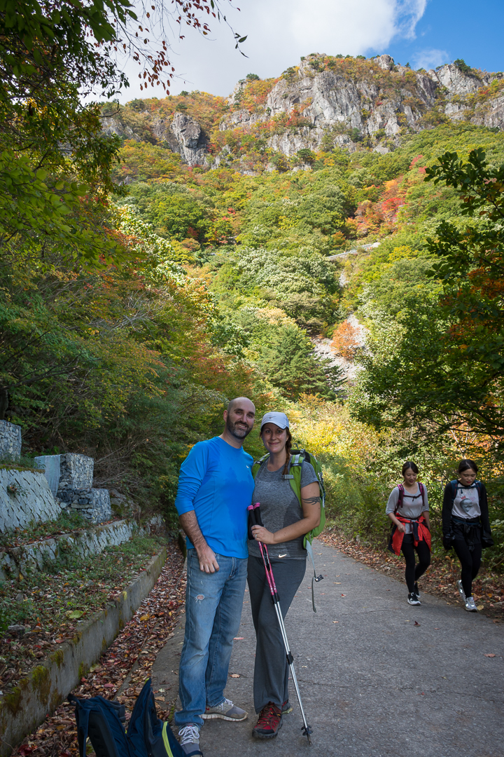
I first visited this area with my husband, Andrew, to see the silver grass back in fall of 2017. At that time, we only visited the main area of Ganwoljae to see the silver grass. The weather was beautiful at that time of year so this blog post will include pics from then as well as my more recent solo hike in spring of 2019 which covered three more peaks.
Along the access utility road - Fall 2017
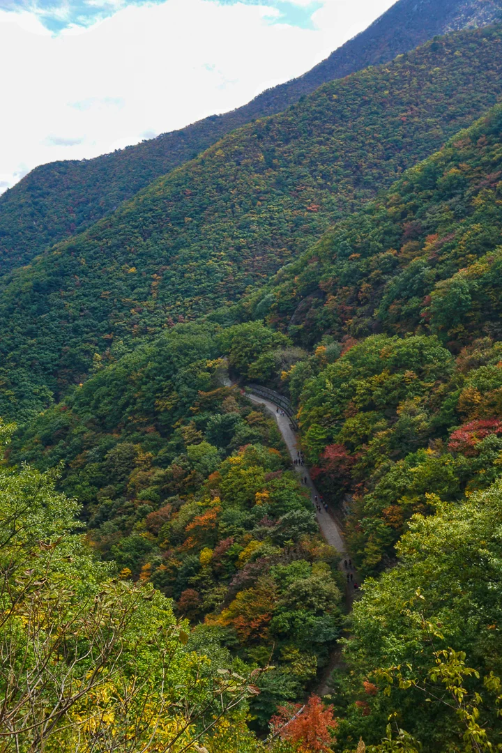
Looking back at the access utility road - Fall 2017
The trailhead starts here where there is plenty of parking. Getting up to the main ridge line involved a lot of walking on a steep fire access road, but the trail begins in the forest with a few different routes you can take to reach the top. The trail is quite well marked so I won’t tell you which way to turn at each junction. The main thing is to head for Ganwoljae. This is the wide open ridge line filled with silver grass, wooden walkways, picnic tables, bathrooms, and even a building where you can buy some ramyeon to reward your efforts. You’ll most definitely want a rest once you’ve made it this far.
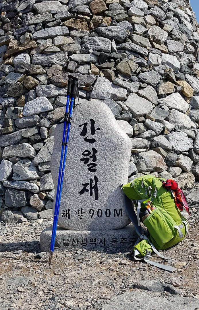
The summit stone for Ganwoljae - Spring 2019

Ganwoljae - Fall 2017

The silver grass at Ganwoljae - Fall 2017
After taking a rest, get ready to reach your first mountain peak of the day, Ganwolsan, it is 0.7km to the right. Go past the large building and head up the wooden stairs before veering to the left. There will be plenty of great views along the way. Once you reached the peak, you’ll have to double back, but this is the only part of the hike in which you’ll have to cover the same ground.
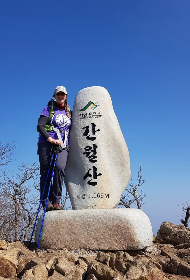
The peak at Ganwolsan - Spring 2019
Views along the trail towards Ganwolsan - Fall 2017
Yeongnam Alps (Ganwoljae) - Spring 2019
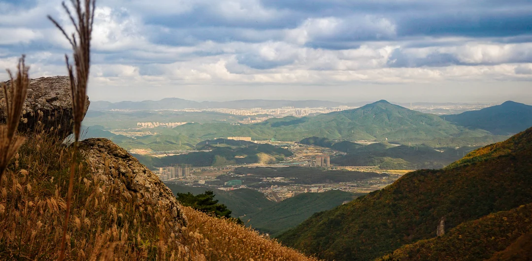
Back at Ganwoljae again, you’ll continue straight, heading up the mountain towards Sinbulsan. It’s about 1.3km to reach the next peak. Unfortunately, the pollution (fine dust) was terrible on the day that I chose to hike the Yeongnam Alps solo, but I persevered since I had already booked a non-refundable hotel in the area. I could see the views towards Ulsan were amazing, but I can only imagine how beautiful they must be when the air is clear.
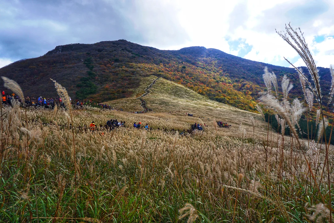
Silver grass for days! Looking towards Sinbulsan direction. - Fall 2017

Sinbulsan - Spring 2019
The stretch between Sinbulsan and Yeongchuksan was much quieter than the previous sections of trail. I had only encountered 2 other people on this stretch. If you’re feeling doubtful at this point about finishing the hike…don’t! You should press on. Although you still have a big distance to go, it gets easier from this point onward. You’ll mostly be hiking along the ridge line for a few kilometers before reaching the final summit of the day: Yeongchuksan!

Looking back towards Ganwolsan and Ganwoljae - Spring 2019
After getting your pictures at the summit stone you can start heading down the mountain, There are a few different ways you can go, but head in the general direction that has been to your left for the hike. You climb down a steep trail for a little while. Eventually you will come across some signs pointing towards Banggi Village which has a pink marker (there is no English on the sign) or Jinae Village ( a blue marker on the sign). I’ve heard from a fellow hiker that the blue trail was much easier on the knees and as a bonus bypassed a hiking shack that sells cold beer and makgeolli, so of course I chose that way.
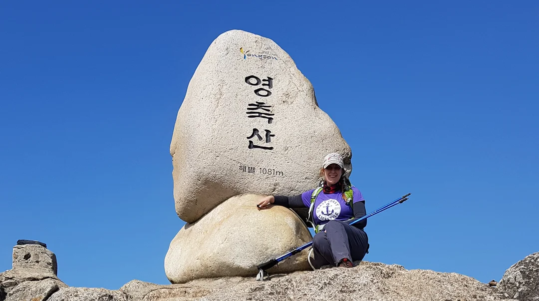
The final peak for the day: Yeonchuksan! Apparently I was too tired to even stand up at this point. - Spring 2019

Eek! A military shooting range! - Spring 2019
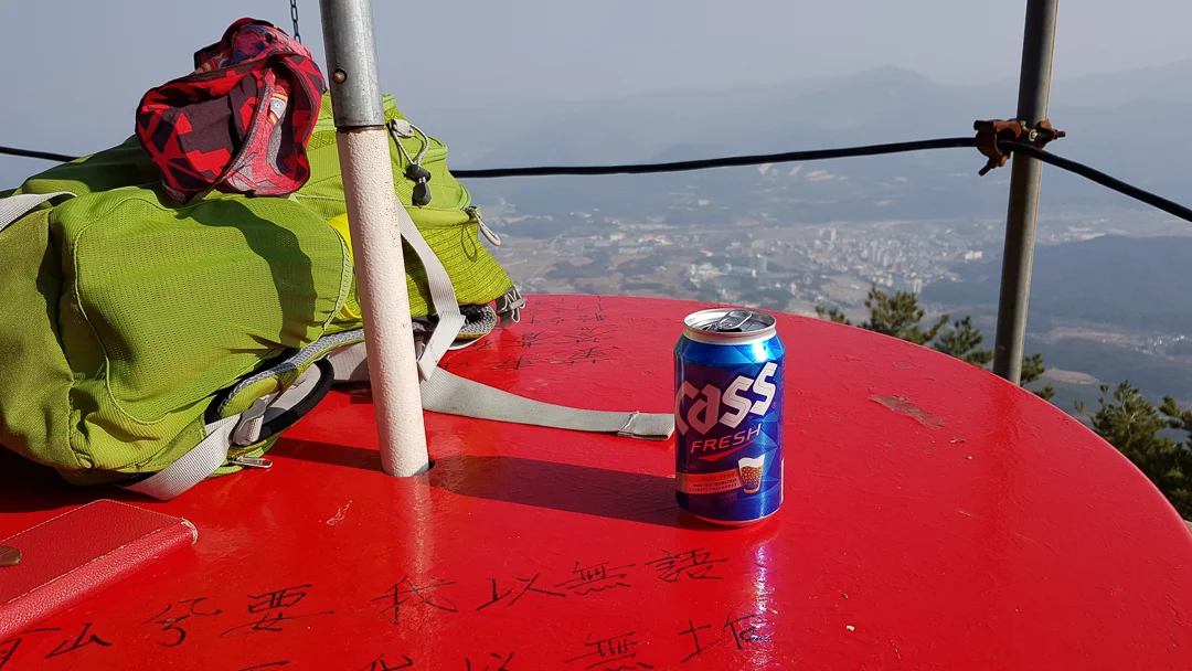
Having a much deserved beer on the way down. I would have loved to have a second but I still had to drive to my hotel post hike. - Spring 2019
By choosing this route, the trail turns into what seems like a never ending utility road. Eventually though you will emerge near Tongdo Fantasia, an amusement park. From here, if you have a car, you can take a taxi back to the trailhead for about 15,000₩.
Despite a percentage of this trail being utility roads, this was one of the most challenging hikes I’ve done (it was tougher than Hallasan). Nevertheless, I would still highly recommend it if you’re up for the challenge!