
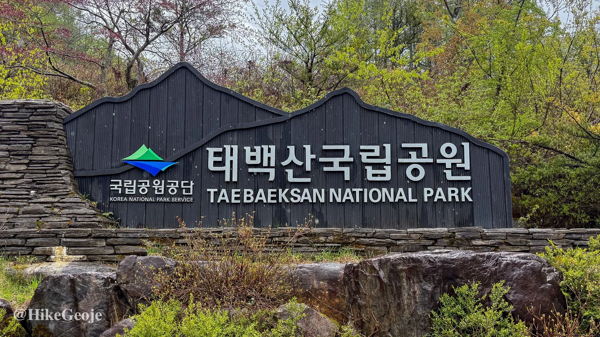
taebaeksan national park 태백산 국립공원
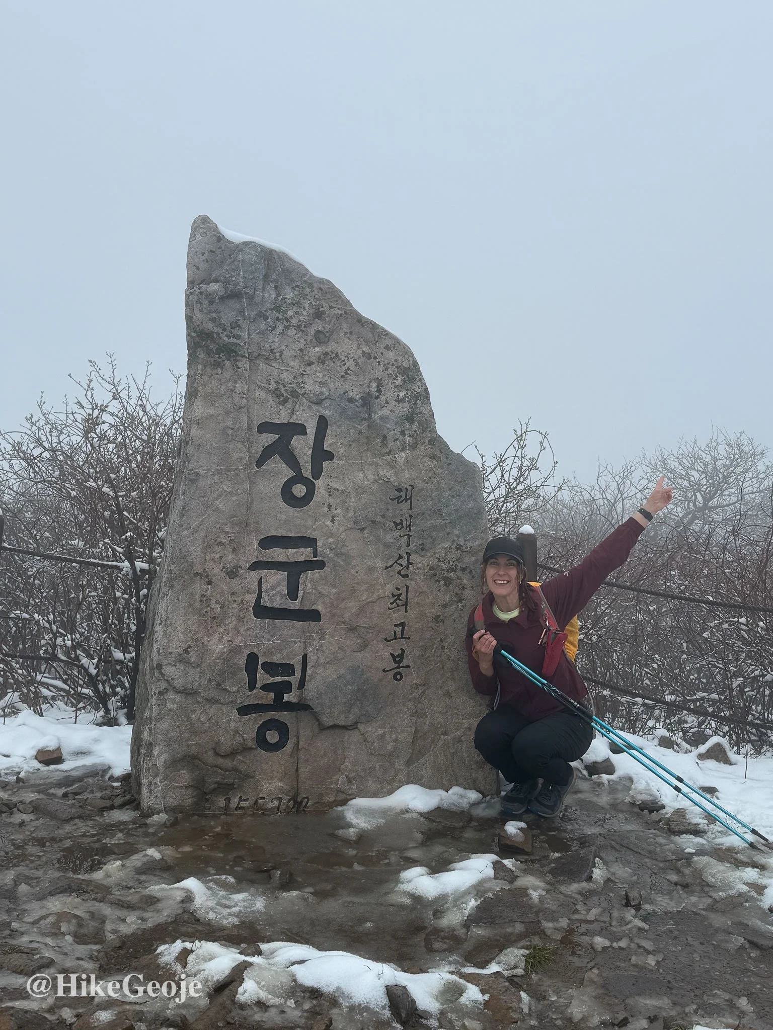
Janggunbong 장군봉 1567 Meters
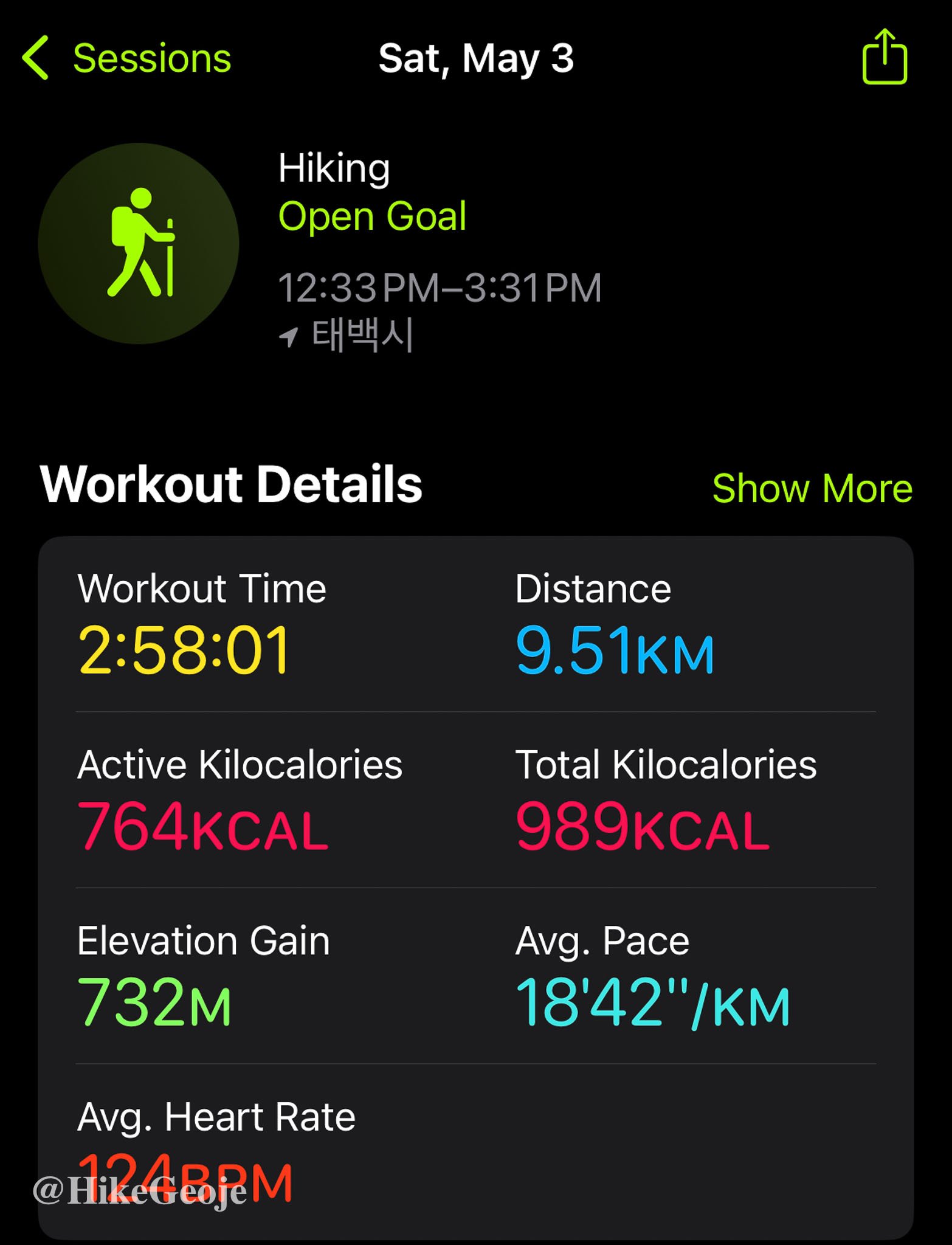
9.5km return (approximately)
📍trailhead
Trail Specs & Details
Distance: ~9.5km return (varies depending on route and side trails)
Elevation Gain: ~732m
Starting Elevation: ~890m
Highest Elevation: 1567m
Time: ~3 hours (steady pace)
Trail Type: Out-and-back (Danggol Entrance to Cheongjedan)
Trailhead: Danggol Entrance (당골탐방지원센터)
Key Highlights: Manggyeongsa Temple, mountain stream, spring wildflowers, summit shrine, unexpected snow
Trail Difficulty: Not very technical—gentle grades and mostly wide paths make for an easy, enjoyable hike
BAC 100: ✅ Official summit on the Black Yak 100 Peaks Challenge
Taebaeksan may be famous for its snow-covered winter landscapes, but this spring solo hike delivered its own surprise: a sudden return of winter weather at the summit. With a peaceful trail, a steady climb, and a summit shrine to top it all off, it’s a rewarding hike—just be prepared for mountain mood swings, even in May.

BAC 100 Solo Adventure: Snowfall in Spring on Taebaeksan
Gangwon-do Hiking Trip – Day 1 (May 2025)
For the May long weekend in 2025, I set off on a solo hiking trip to Gangwon-do with an ambitious goal: to tackle four peaks from the BAC 100 Summit Challenge—Taebaeksan, Hambaeksan, Dutasan, and Deokhangsan. It’s a long haul from Geoje to Gangwon-do (about six hours by car), so I planned to make the most of every minute up north.
First Stop: Taebaeksan
My first destination was Taebaeksan, a mountain I had hiked once before back in 2018—blanketed in its famous winter snow. This time, I was eager to see it in spring bloom. But Taebaeksan had a surprise waiting for me.
I arrived at the Danggol Entrance under a light drizzle. A bit of rain wasn’t going to stop me after such a long journey, so I grabbed my umbrella and set out.
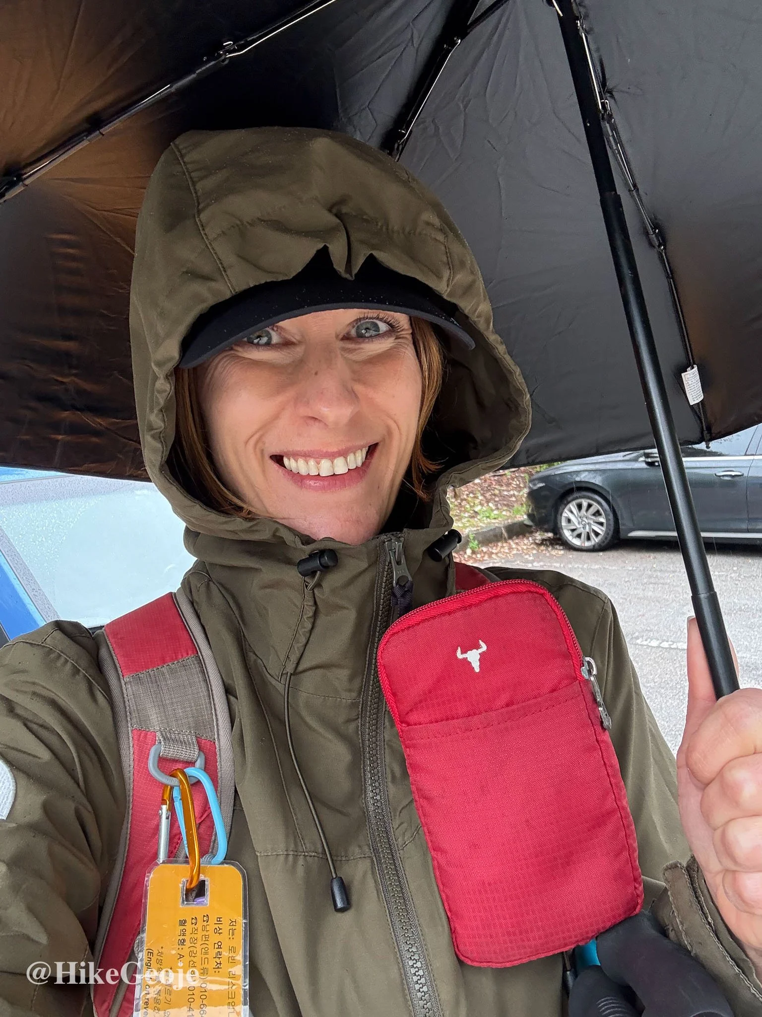
Oddly, despite being in a national park, I struggled to find the trailhead. After a bit of wandering (and silently hoping another hiker would show up to follow), I finally located it in the back right-hand corner of the final parking lot.
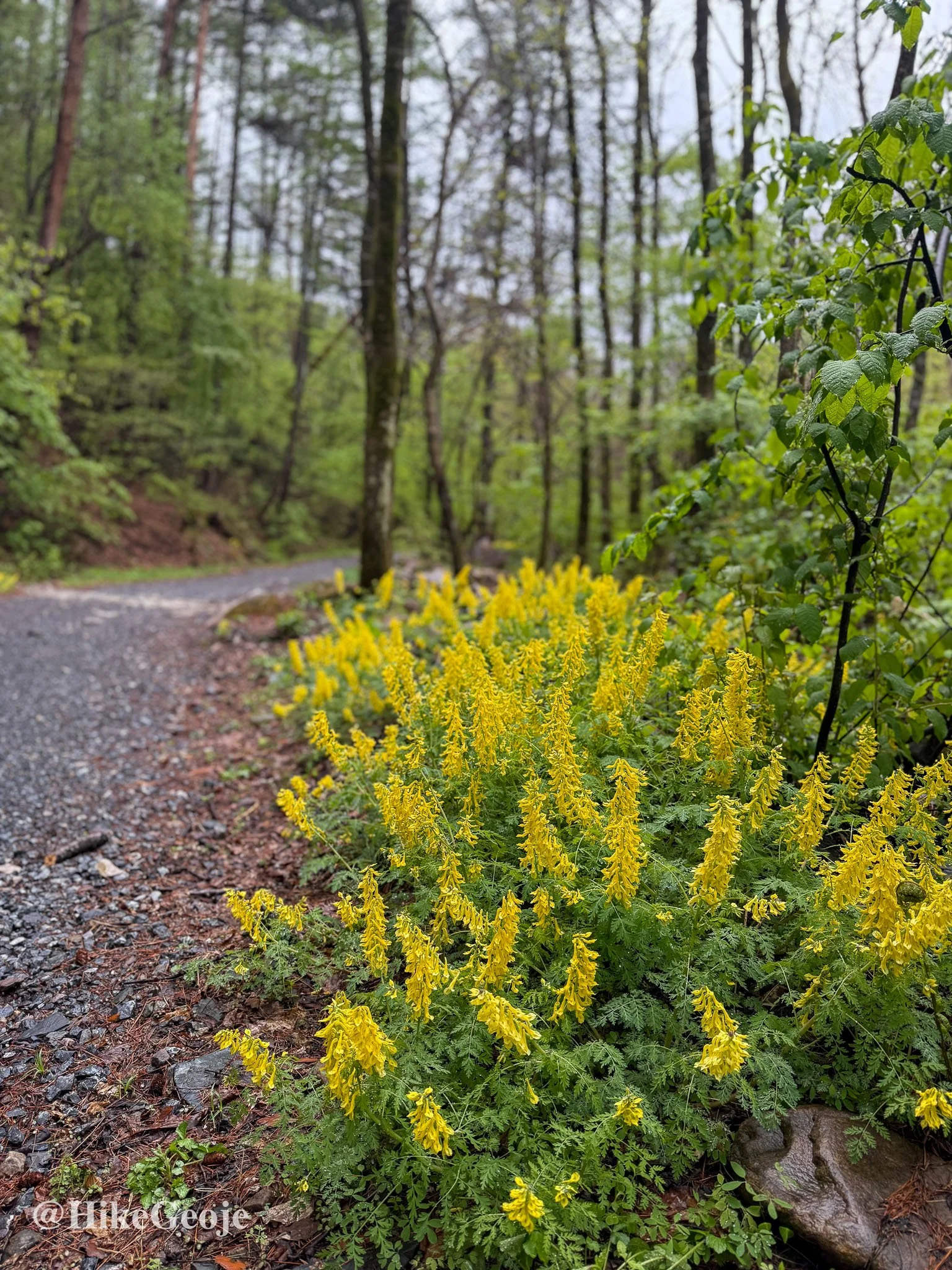
The trail began on a wide road flanked by a stream to the right, flowing strong and clear from the mountain runoff. Just beyond the start, I passed a small temple on the left and spotted some cheerful yellow flowers—the only real sign of spring I'd see that day.
Following the Trail Up
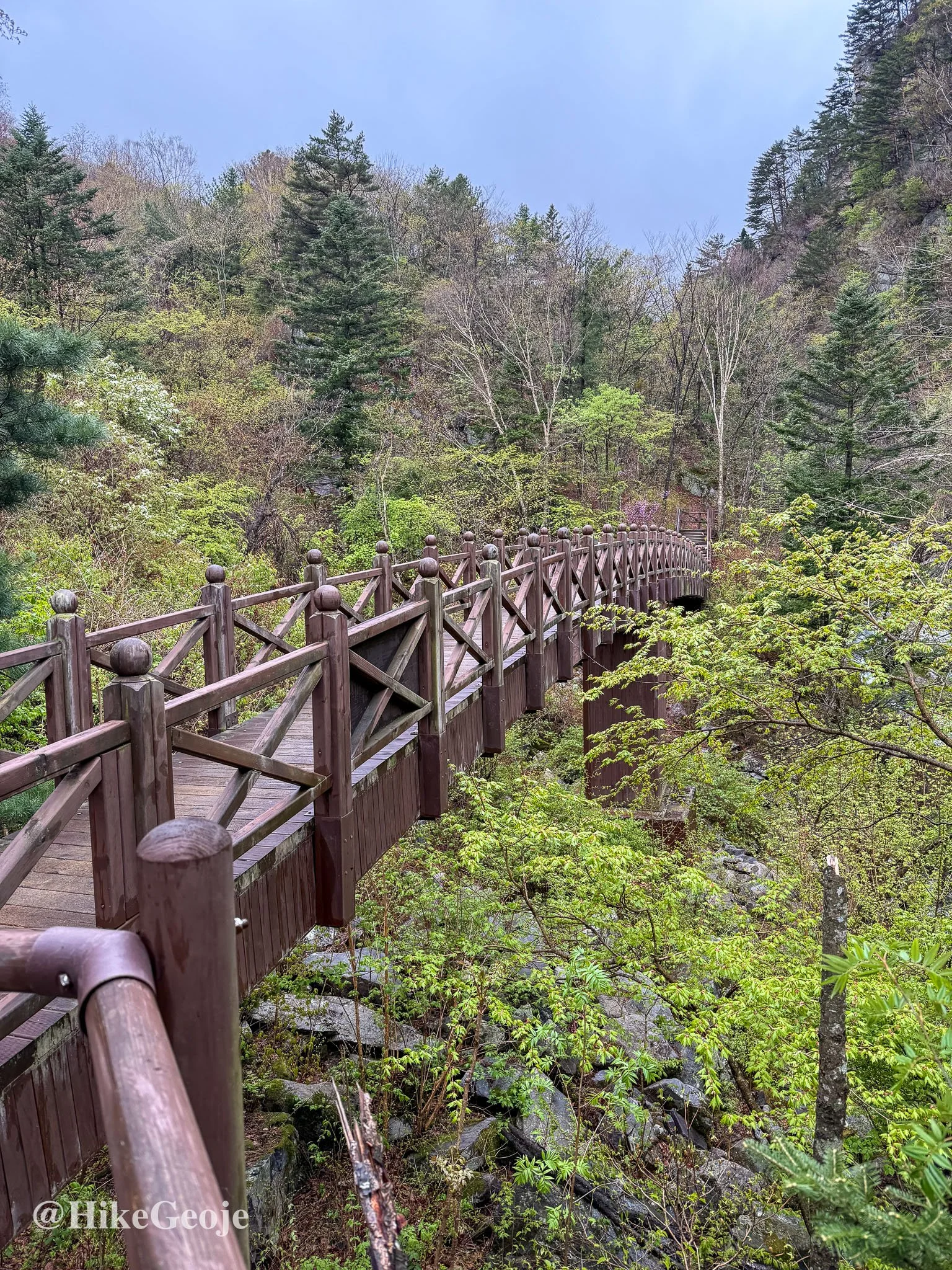
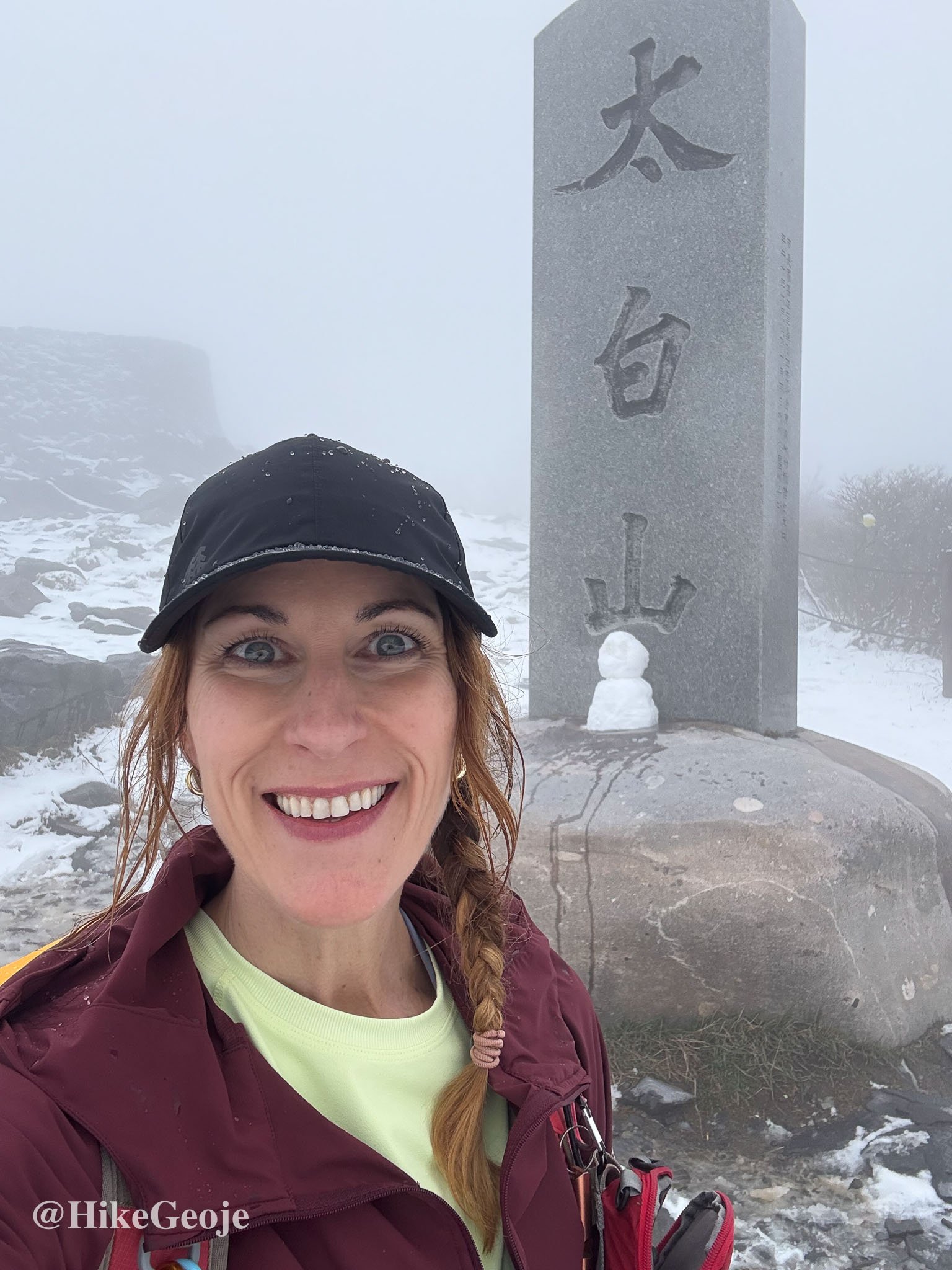
My only goal was to reach Cheongjedan (천제단), Taebaeksan’s summit, for my BAC 100 check-in, so I stayed to the right at the first junction. The climb began gradually, and I eventually crossed a lovely wooden bridge after another turn.
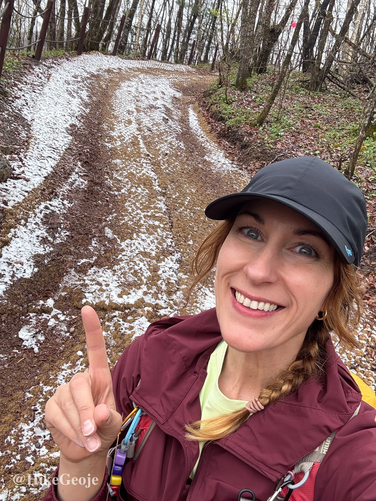
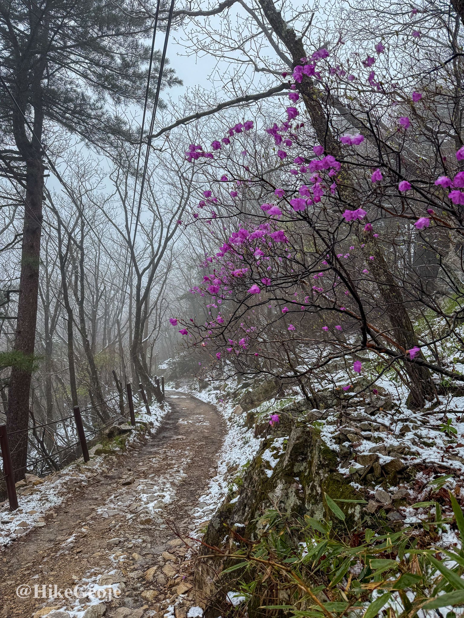
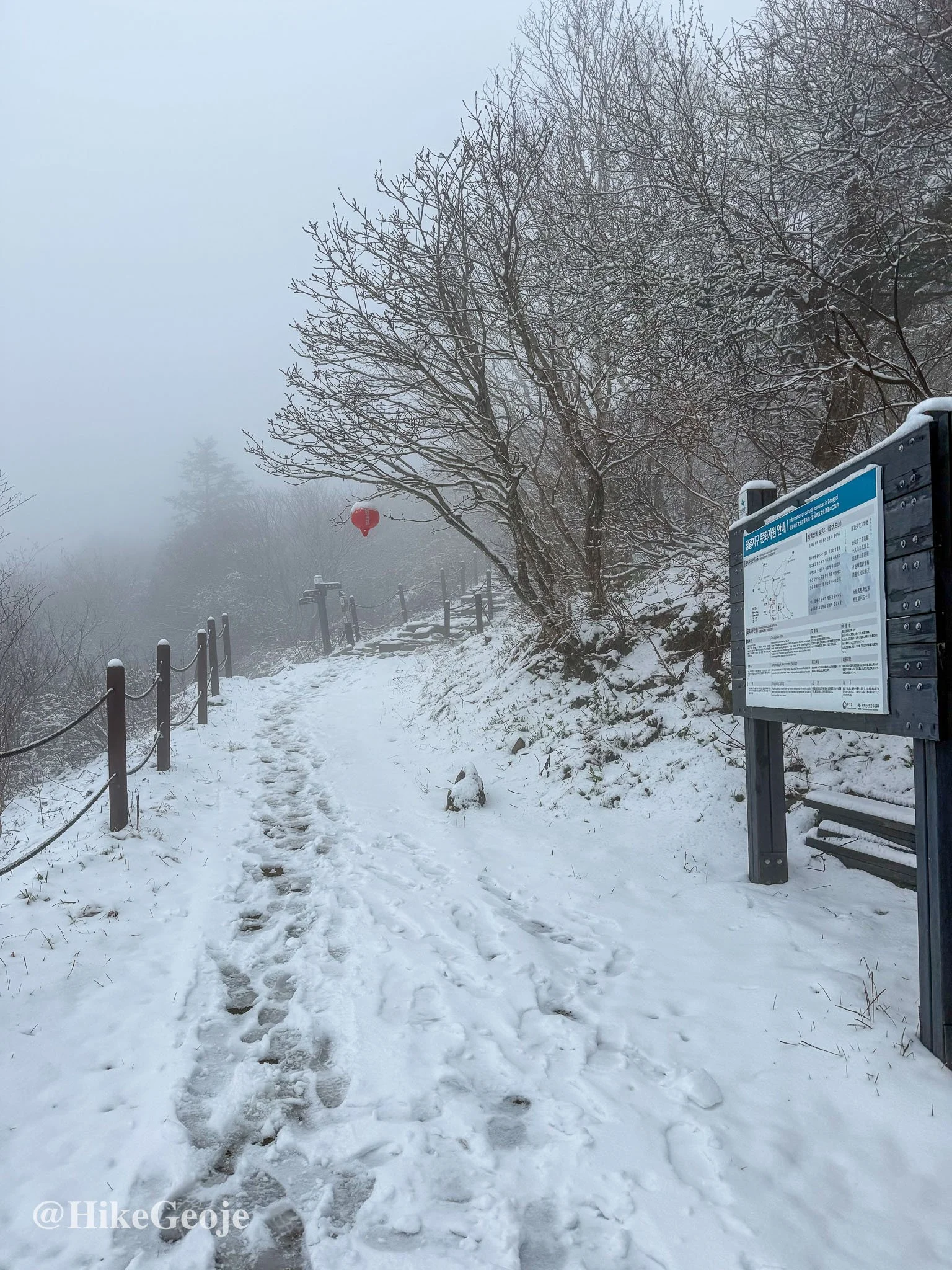
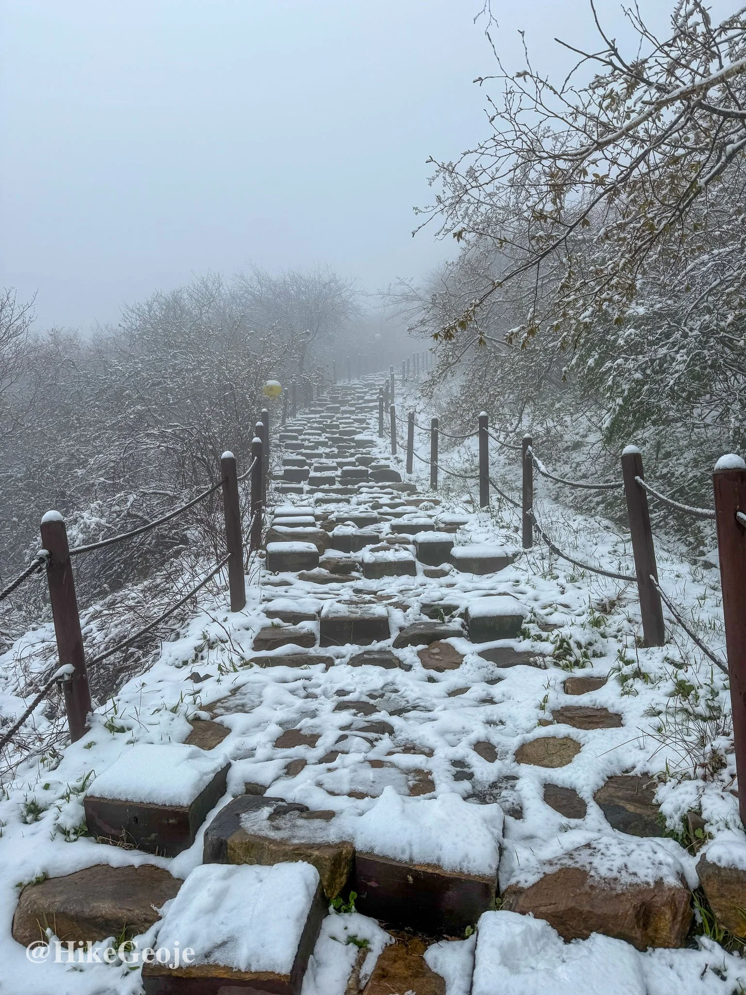
As I gained elevation, I noticed something odd—patches of snow! Not old, dirty remnants of winter, but the fresh, white stuff! I couldn’t believe it. While I’d started the hike in light rain, it had clearly been snowing up here. The trail became muddier and more slippery with each step, and the temperature dropped significantly.
Snowy Surprise and Cold Realizations
At one point, I detoured to check out Manggyeongsa Temple, near the summit. By then, I was soaked, cold, and starting to realize I wasn’t fully prepared for wintery conditions in May. I had been so focused on chasing spring blossoms, I hadn’t packed for snow. Lesson learned.
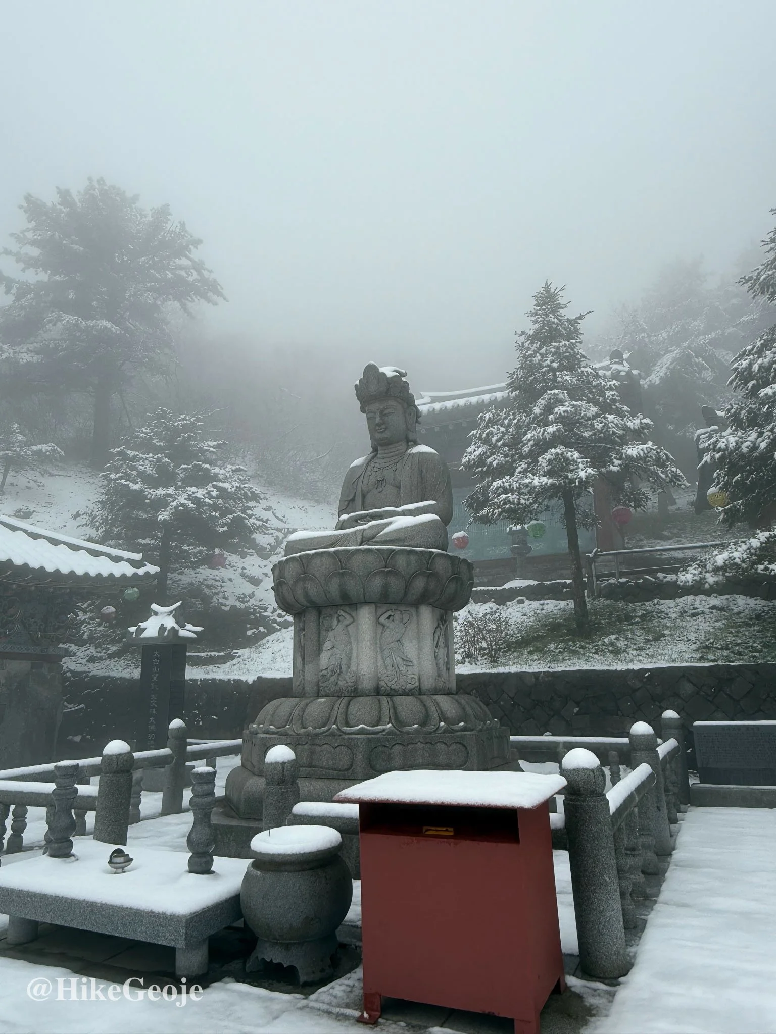
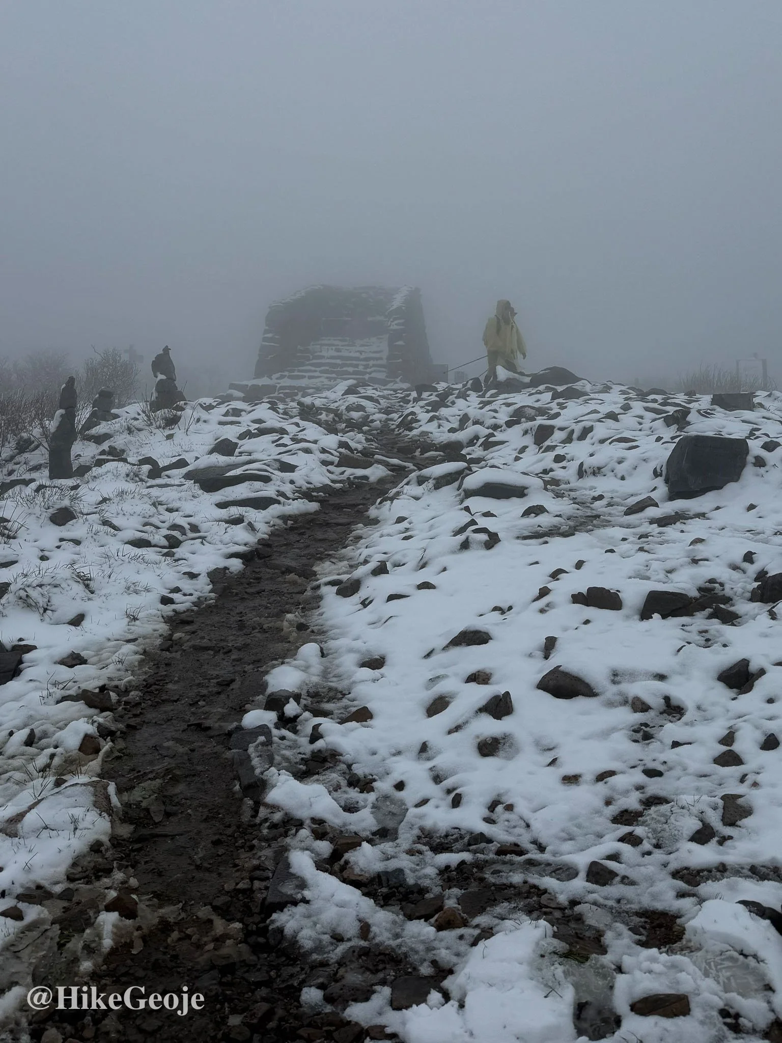
After a quick visit, I pushed on to the summit. I snapped a few photos at the Cheongjedan summit stones, then made the call to abandon my original plan—a longer ridge trail loop that would’ve taken me to Buseobong and Munsubong. I was cold and wet, and while retracing my steps wasn’t the most exciting option, it was the safest.
Back to Base and Onward
I hurried back down the mountain, grateful to feel the snow turn to rain again and warm up a little. The hike had started with excitement over spring wildflowers and a new trail—but turned into a good reminder about being prepared for sudden weather shifts in the mountains, especially in higher elevations.
Despite the cold, I was thrilled to check Taebaeksan off my BAC 100 list and ready to drive a short distance to my next goal: Hambaeksan!