
GEOJE RIDGELINE TRAIL 거제 마운틴 트레일
DAY 2
nojasan 565METERS (optional)
garasan 585METERS
mangsan 397METERS
APPROXIMATELY 17KM
📍official trailhead
📍recommended trailhead
So right off the bat, I’ll start by saying that the second half of the GRT is much more difficult than the first. The first time i completed it, my friend and I were miserable throughout the last third of the hike, Mangsan. If there were any easy way to get off the mountain I’m sure we would have quit.
This year when hiking the second half, it was later in the day when my hiking buddy, Calvin, and I finally emerged onto the roadway before starting Mangsan so we made the decision to not start that leg of the trail. I was pretty worn out from hiking serveral times that week and didn’t want a repeat of the year before.
Instead I headed off to complete Mangsan on a third day, with Ashleigh and Mike in tow, and I’m so happy I did. Mangsan is an amazing mountain and it really should be appreciated. So with that said, there’s no shame in dividing this leg of the GRT into two days to have enough time and energy to take it all in.
The official trailhead, starts a little passed Geoje Natural Recreation Forest, which is directly across the street from the end of the Hakdong Gogae Pass. The GRT has been marked following the directions that can be found on the facebook page for the GRT, which technically doesn’t include Nojasan. Nojasan is along the same ridgeline so i would definitely recommend making a detour to the right once you reach the ridge and covering that peak, too.
If you would like to also complete Nojasan as part of this hike, I would recommend this trailhead, which is different from the one recommended in the official GRT guide, but it will prevent you from having to cover the same ground twice and it’s closer to the end of the GRT Day 1. Simply follow the ridgeline and once you pass Nojasan continue on, eventually you’ll merge up with the GRT trail and you can continue to follow the ribbons from there.
As mentioned, for this most recent time hiking the GRT, I followed the official route, so my description and pictures will be in line with that.

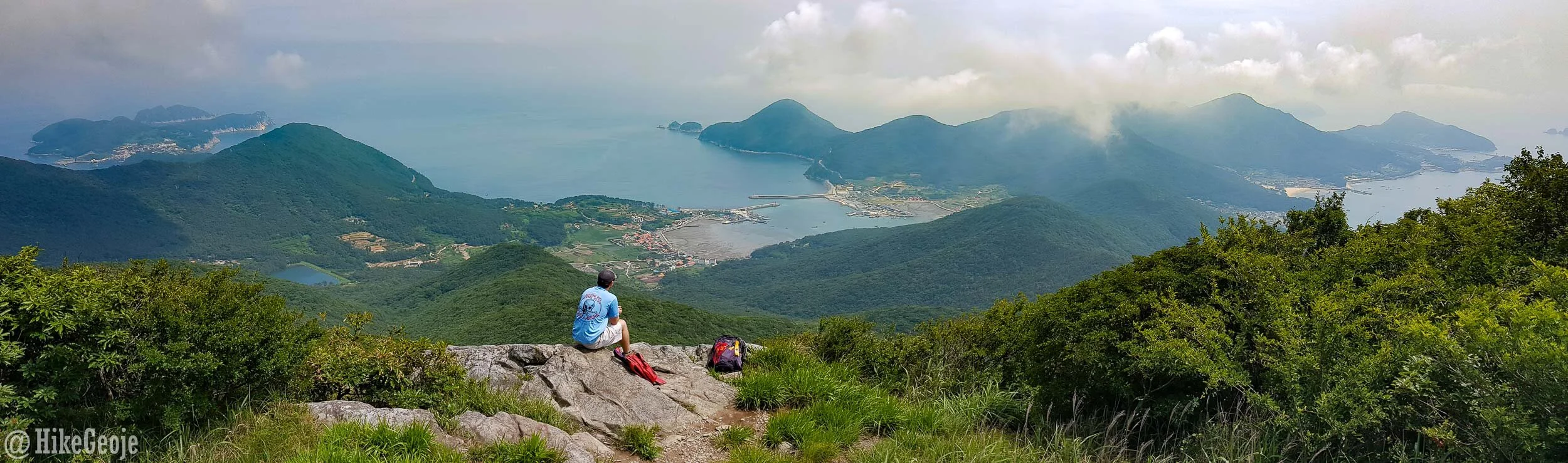
Calvin the conqueror!

Looking towards Nojasan.
Once you reach the ridgeline, you’ll be turning right, assuming you’re going to head to Nojasan as well. Along the way, there are several rocky outcrops with some great views. At one point it will seem like you are about to climb back down the mountain, but follow the trailmarkers, it simply goes down to bypass some rocks that are too hard to go over.

You’ll pass a 2-story gazebo along the way. There is currently no roof on it. I’m not sure if it’s in the process of getting replaced or not though. Soon enough you’ll come to the first peak of the day: Nojasan!

Now it’s time to turn around and head back in the direction you came from. There will be several little side trails leading to some pretty great views and platforms along the way to Garasan. Make sure you check each one, because you don’t want to miss any.


After a while you’ll emerge at Garasan. Despite this being the tallest peak in Geoje, the summit stone is pretty unremarkable and not really in an area with any views.


Once you pass over the top of the mountain, continue for about another 500 meters, there you will find a short side trail. DO NOT MISS THIS OFFSHOOT! I’ve hiked Garasan three times, and only found out about this gazebo and view on my most recent hike with Calvin. This very well may be the absolute best mountain view in all of Geoje, in my opinion. The pagado has some rotted out stairs leading up, but the rocks in front are a better place to sit for a picnic and rest anyway.
Sidenote: Since this original blogpost was written, there is now a large wooden platform here as well as clear signs pointing to the area. To see a more current breakdown of the area, you can checkout the updated Garasan post.

Taken from the aforementioned gazebo.
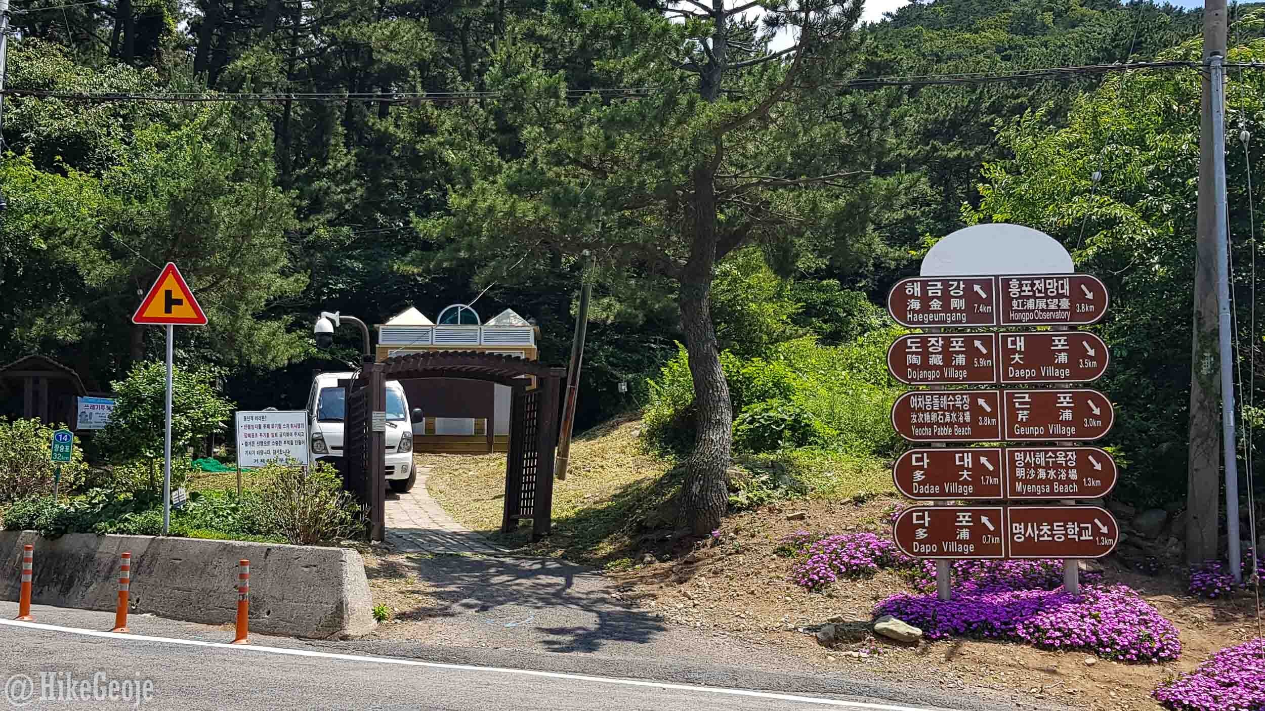
After you’ve gotten your fill of the views, head back to the main trail before slowly making your way off the ridgeline. Eventually, you’ll emerge onto the roadway trailhead here in Myeongsa. From here you’ll need to make a decision on whether or not to hike Mangsan on the same day. Allow yourself 4 to 5 hours of daylight hiking. I wouldn’t recommend starting if you are at all tired at this point.
Once you’re ready to continue, turn right and cross the street, the trailhead is just a few steps away!

At the exit of the Garasan leg of the trail.
The entrance for Mangsan.
Last stop: Mangsan!
As mentioned, this year, I did the hike over three days, rather than two. For Mangsan, I was accompanied by Ashleigh and Mike and we were so fortunate to have such a clear day. I wore the same outfit for continuity in photos…either that or I really could use some new clothes.
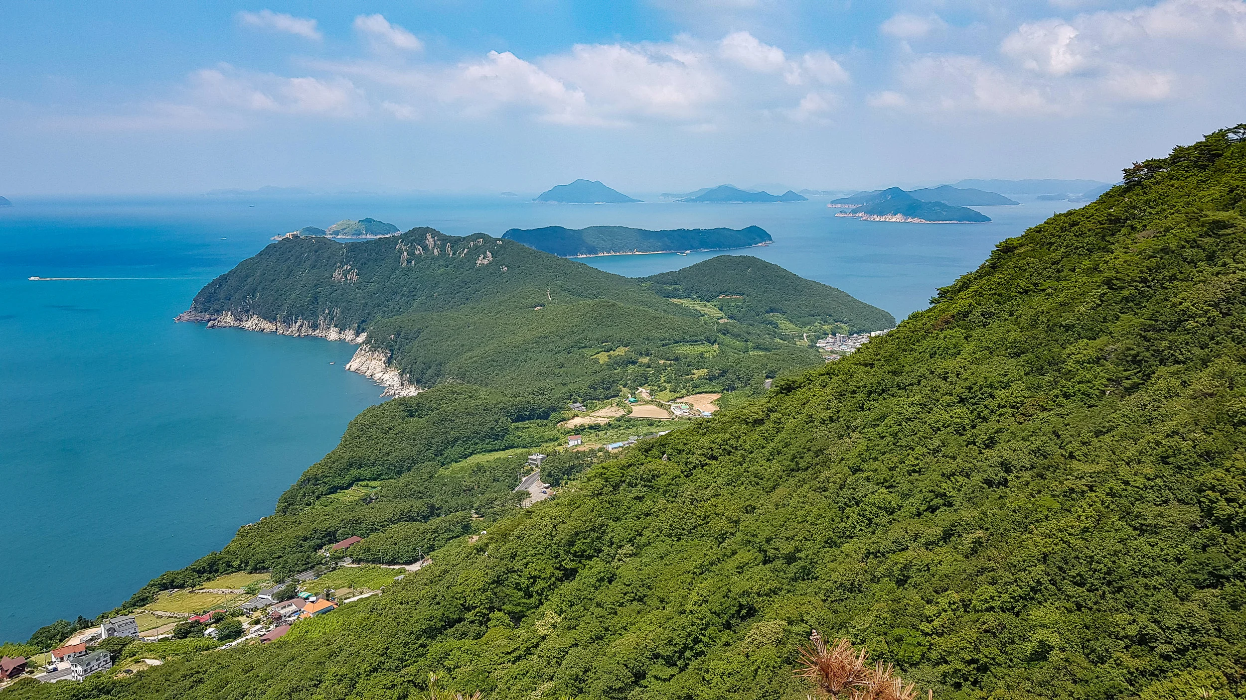
The Mangsan trail is basically shaped like a horseshoe. You’ll be hiking a ridgleline with amazing views of the ocean. The first viewpoint along the way opens up where you can see some views looking back on Garasan. It’s neat to see how big that rocky outcrop with the amazing view was. A little scary, too.
Eventually, you’ll come to a set of some steep stairs which you will take up. If you look behind you, you’ll be looking down on a rocky beach and another small mountain, Cheonjangsan.


Around the center point of the “horseshoe”.
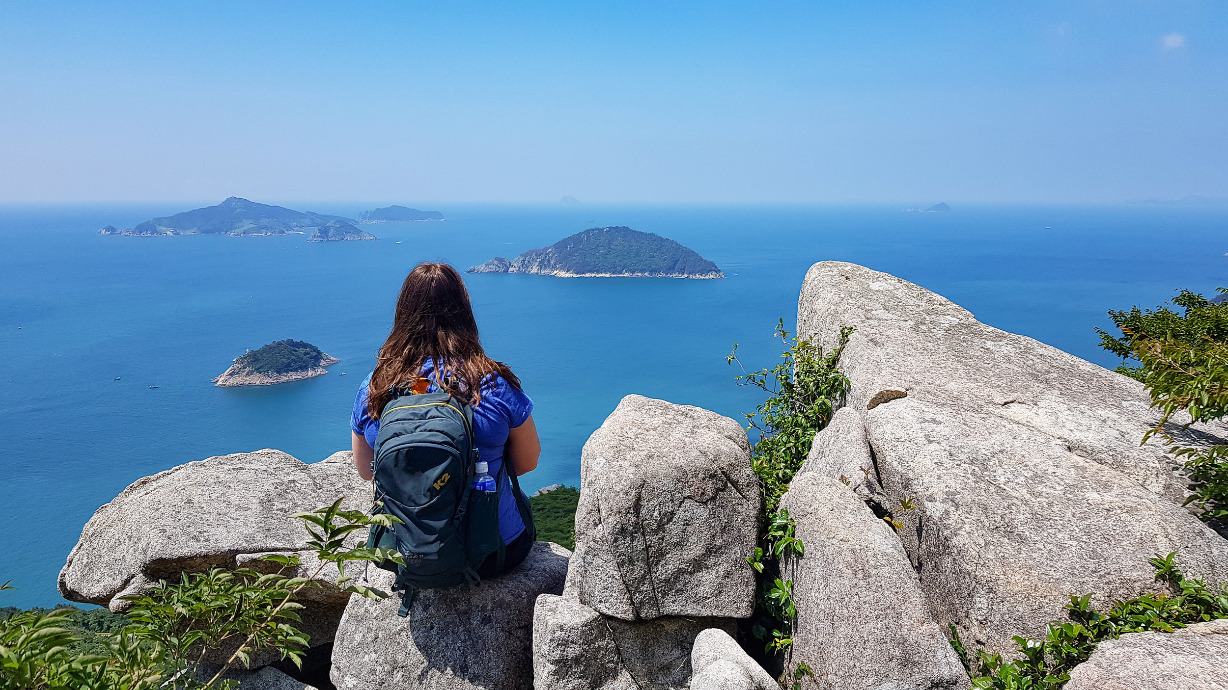
After the section with the steep wooden stairs, the trail will have a lot more rock scrambling. There are a ton of different view points looking to the sea. On a clear day, you can even see the island of Tsushima in Japan (only about 50km from South Korea.) The views back inland are just as stunning as the views of the islands dotting the sea.

Soon enough you’ll come to the summit marker. Once you reach it, you’ll have completed about about two thirds of Mangsan.

We made it!
The posing battle begins!

I’ll give it my best shot.

And we have a winner!


Once you exit the trail here, it’s about 5 minute walk to the waterfront. There’s a convenience store with some picnic tables out front where you can reward yourself with some snacks and drinks for completing the GRT! You’ve earned it!