
geumsusan 금수산
1016 Meters
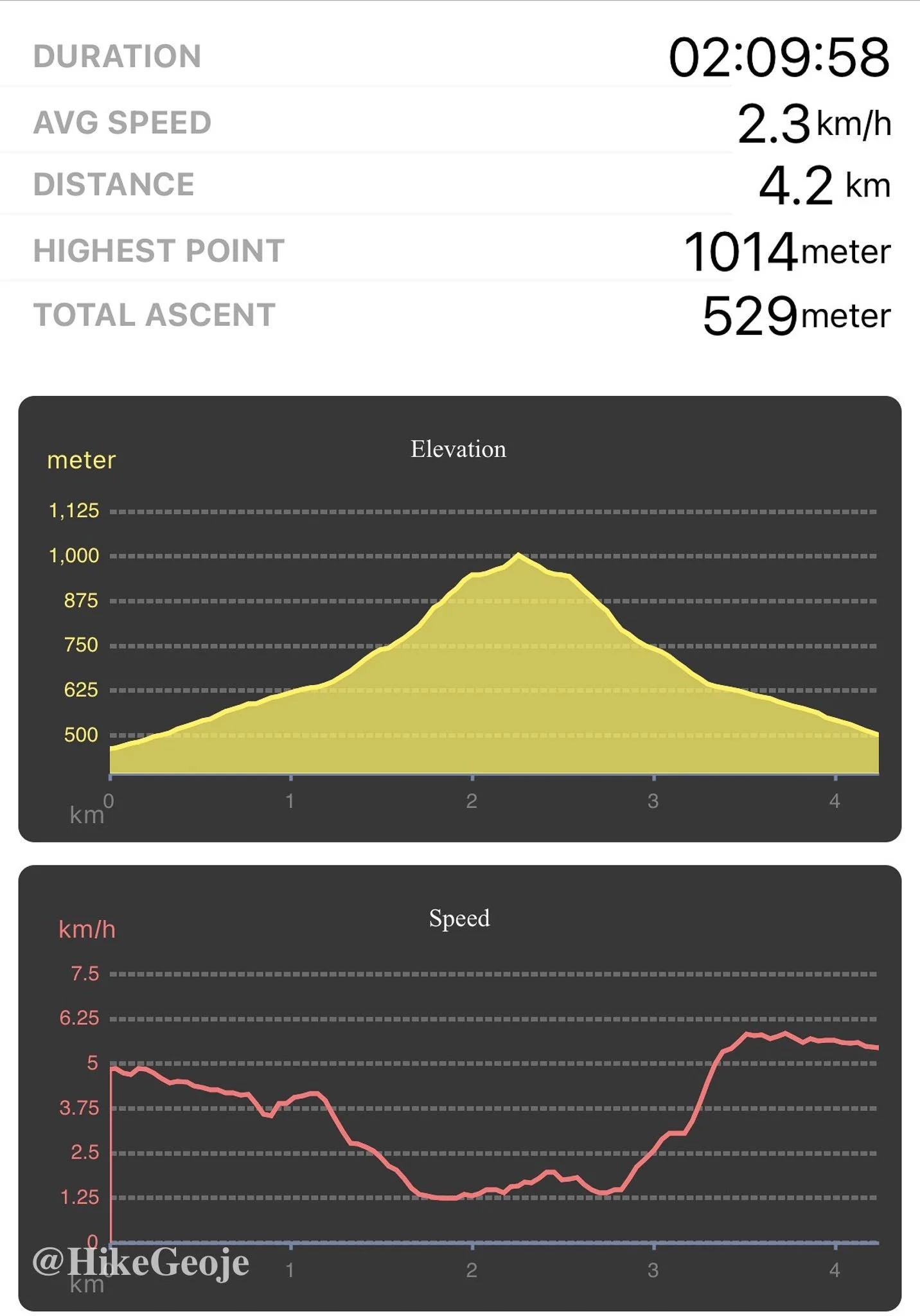
4.2km return
📍trailhead
Trail Specs & Details
Distance: 4.2km return
Elevation Gain: 529m
Starting Elevation: 487m
Highest Elevation: 1016m
Time: ~2 hours
Trail Type: Out-and-back
Trail Difficulty: Not very technical—gentle grades and mostly wide paths make for an easy, enjoyable hike
BAC 100: ✅ Official summit on the Black Yak 100 Peaks Challenge
New Year, Low Energy, Still on the Trail
In January 2026, I started the year with a four day hiking trip through Gangwon-do. The plan was five mountains in four days, but I ended up hiking four. Between recovering from a cold and sleeping poorly after New Year’s Eve, my energy just wasn’t where I wanted it to be.
The night before, I was out with Andrew and friends at the Jangseungpo Fireworks Festival. I didn’t drink, something I’ve mostly cut out since it interferes so much with my sleep, but I still didn’t get into bed until close to 1 a.m. With a 6 a.m. wakeup and plans to be on the road by 6:40, I was already starting the year tired.
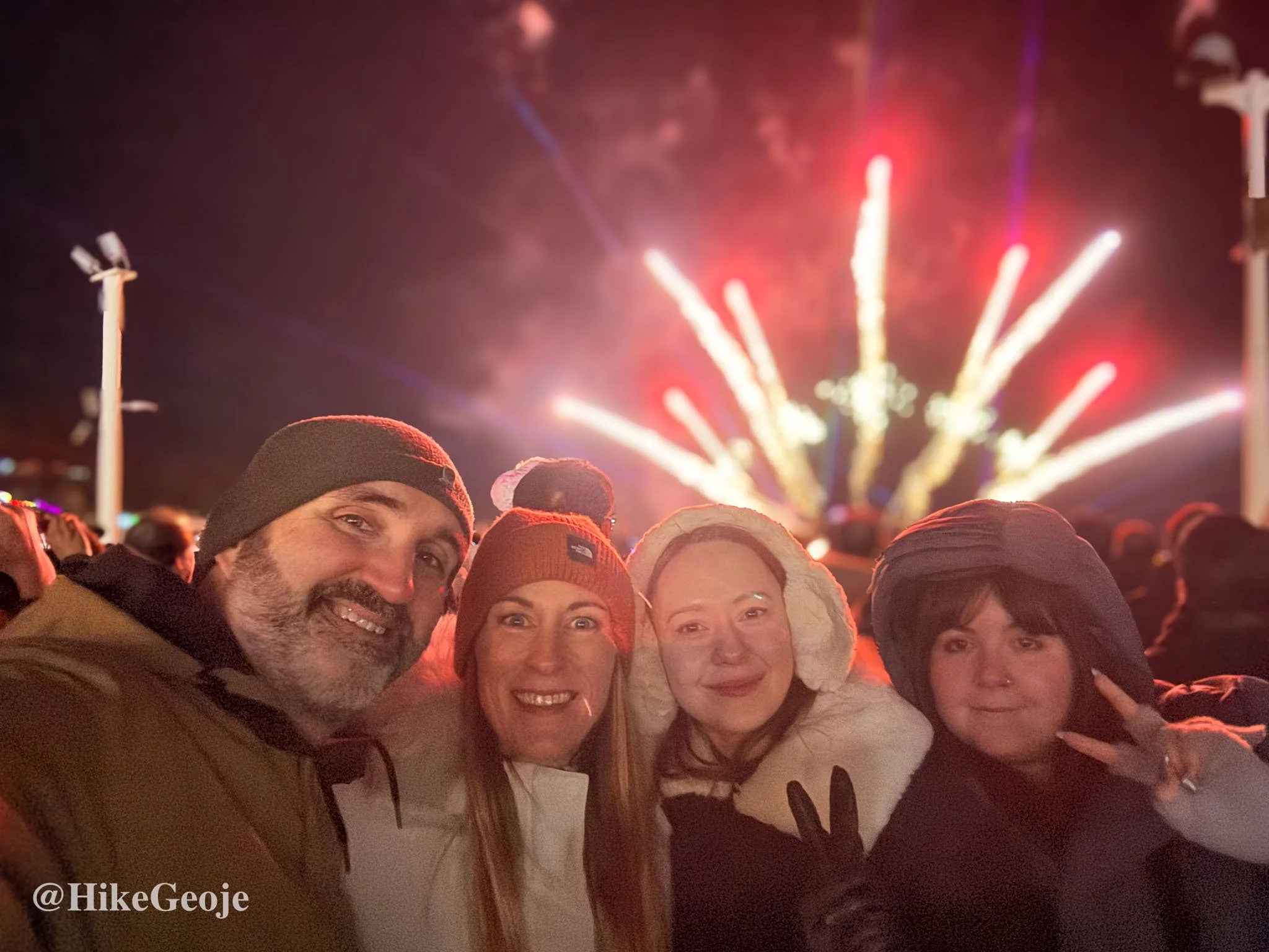
Welcome 2026!
As I left the island, cars lined the highway, people pulled over waiting to catch the first sunrise of 2026. I didn’t stop, but I still got to watch the sun rise over the sea as I passed through Gadeok. Not a bad way to begin the year.
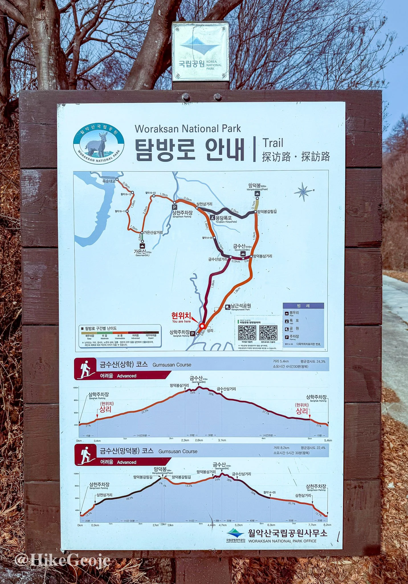
Why Geumsusan
Most of this trip was centered around Odaesan National Park in Pyeongchang, but Geumsusan in Jecheon made a perfect first stop. It is technically part of Woraksan National Park so I guess I got to hit up two National Parks during this trip! It broke up the long drive north without taking me far off route.
I followed a narrow road up the mountain and found plenty of parking. I was feeling good until I realized one of my hiking poles was broken. I left it leaning against the trunk, planning to deal with it later. When I came back after the hike, it was gone. Even out in the countryside, it disappeared completely.
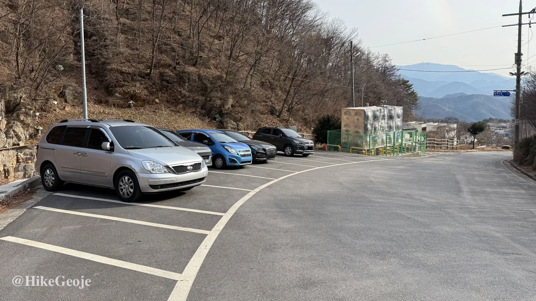
The scene of the crime! Whoever stole my broken pole deserves it!
Cold Temperatures, Easy Start
Despite a real feel of around -12°C, I was warm enough in my puffy coat and Heat-tech base layer. That said, this trip really highlighted the flaws in my winter hiking setup. I tend to sweat heavily on the way up, soak my base layer, and then freeze once I stop moving.
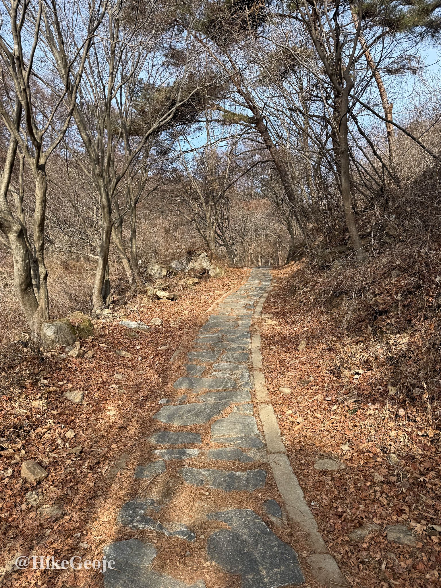
The trail began wide and forgiving, which I appreciated, especially with only one hiking pole. As the incline increased, the lack of balance made it feel noticeably more strenuous than usual.
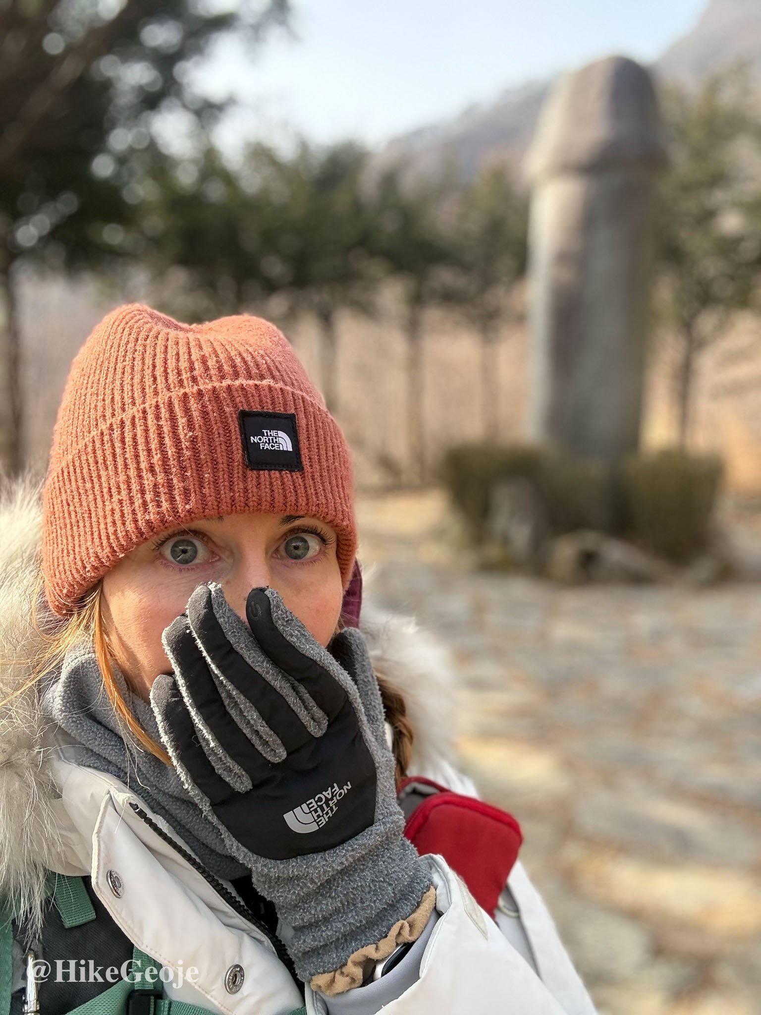
Namgeunseok Park (Phallic Stone Park)
I reached Namgeunseok Park sooner than expected, without fully realizing it would be a “penis park” of sorts. According to local folk belief, the shape of Geumsusan mountain resembles a reclining woman. Legends say that the mountain’s strong feminine energy could be dangerous for men…ha! So a male stone figure was placed nearby to balance it.
Oh my.
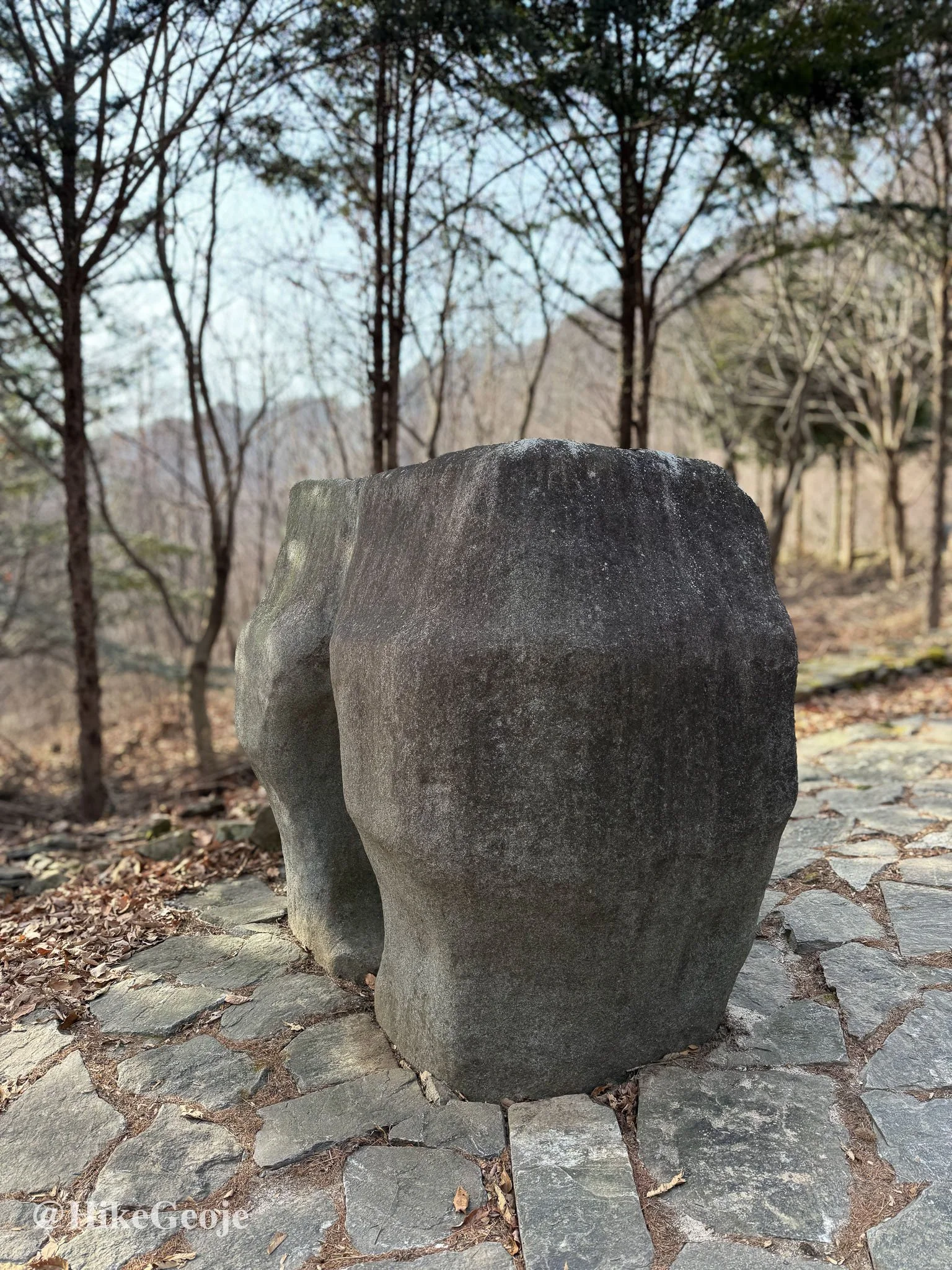
I’m not quite sure that this was supposed to be, but it looked like a butt crack from this angle.
Newlywed couples once visited after their wedding night, believing it would help them conceive a healthy son. Women without sons were also said to have prayed here. I took a few photos, had a little chuckle, and continued on.
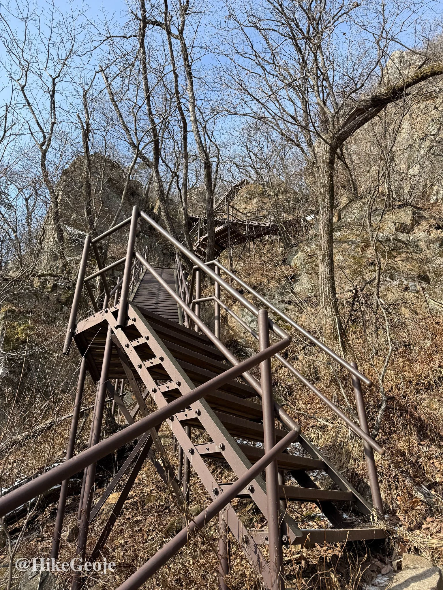
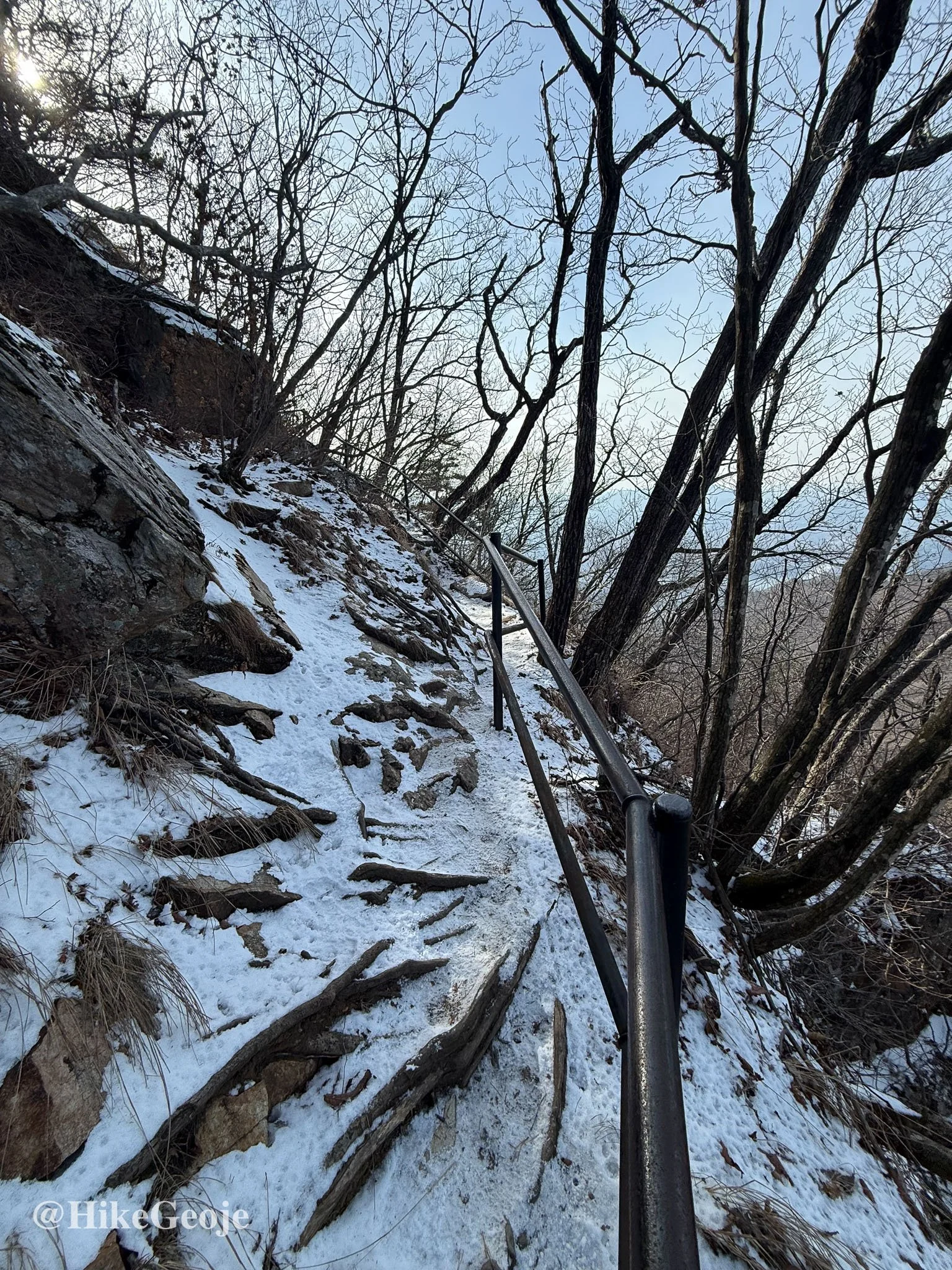
Steep Stairs and Snowy Rock
Beyond the park, the trail flattened briefly before turning rocky and steep, with a steady mix of stairs. I started seeing patches of snow, enough to slow things down but not enough to justify crampons.
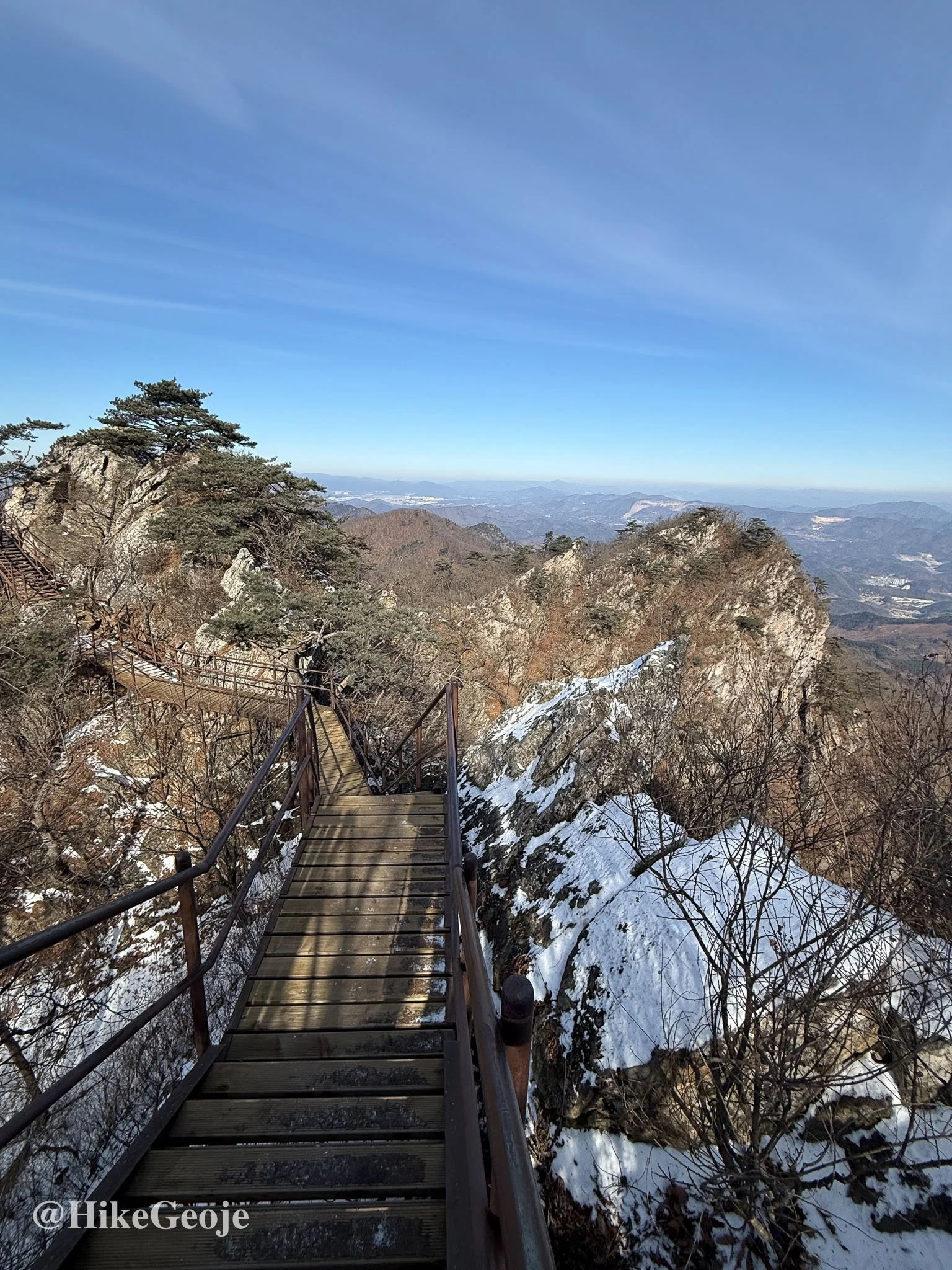
Ridgeline Views
Reaching the ridgeline brought open views that reminded me a bit of Yeohangsan in Haman, which I had hiked the previous summer.
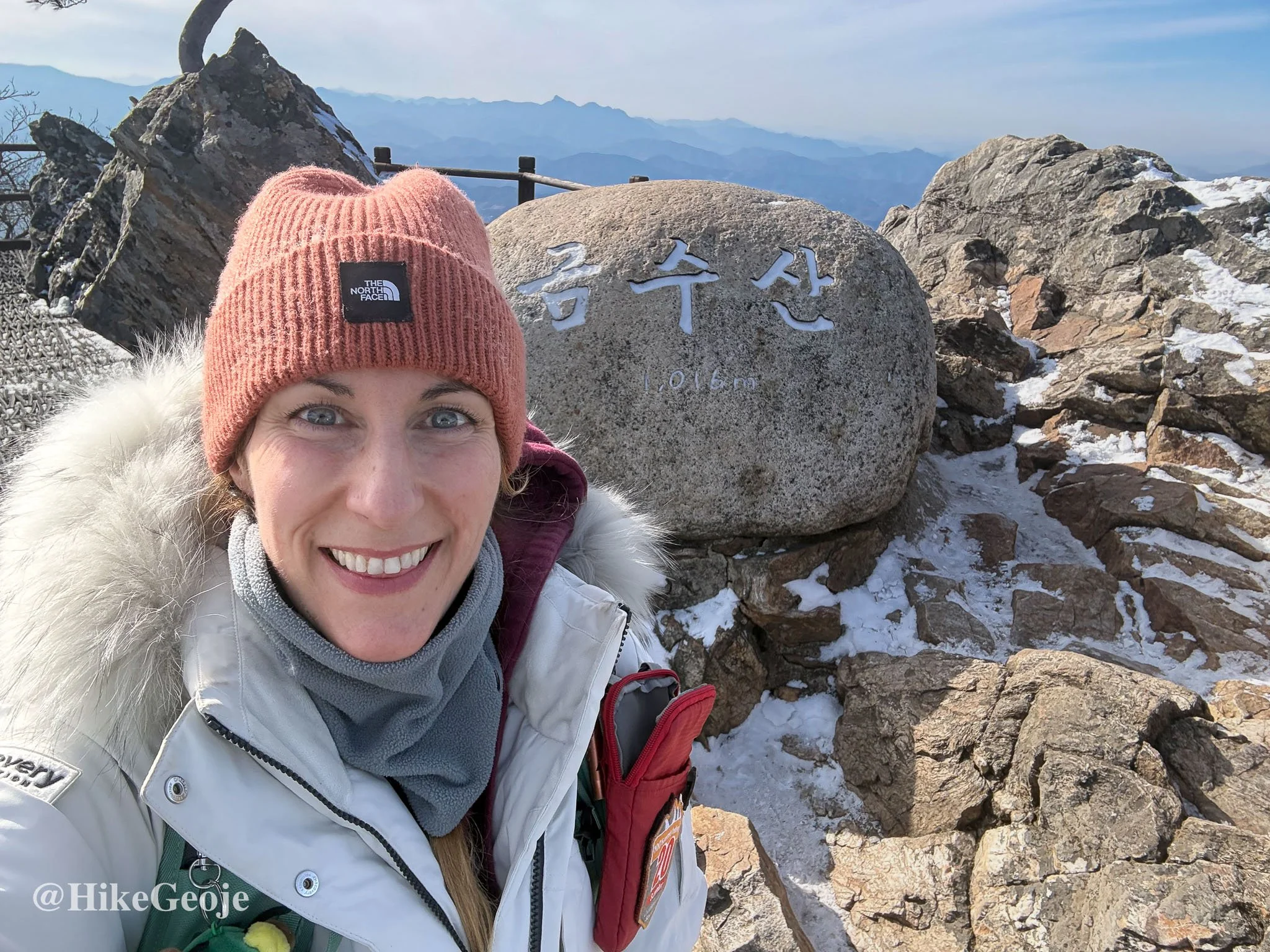
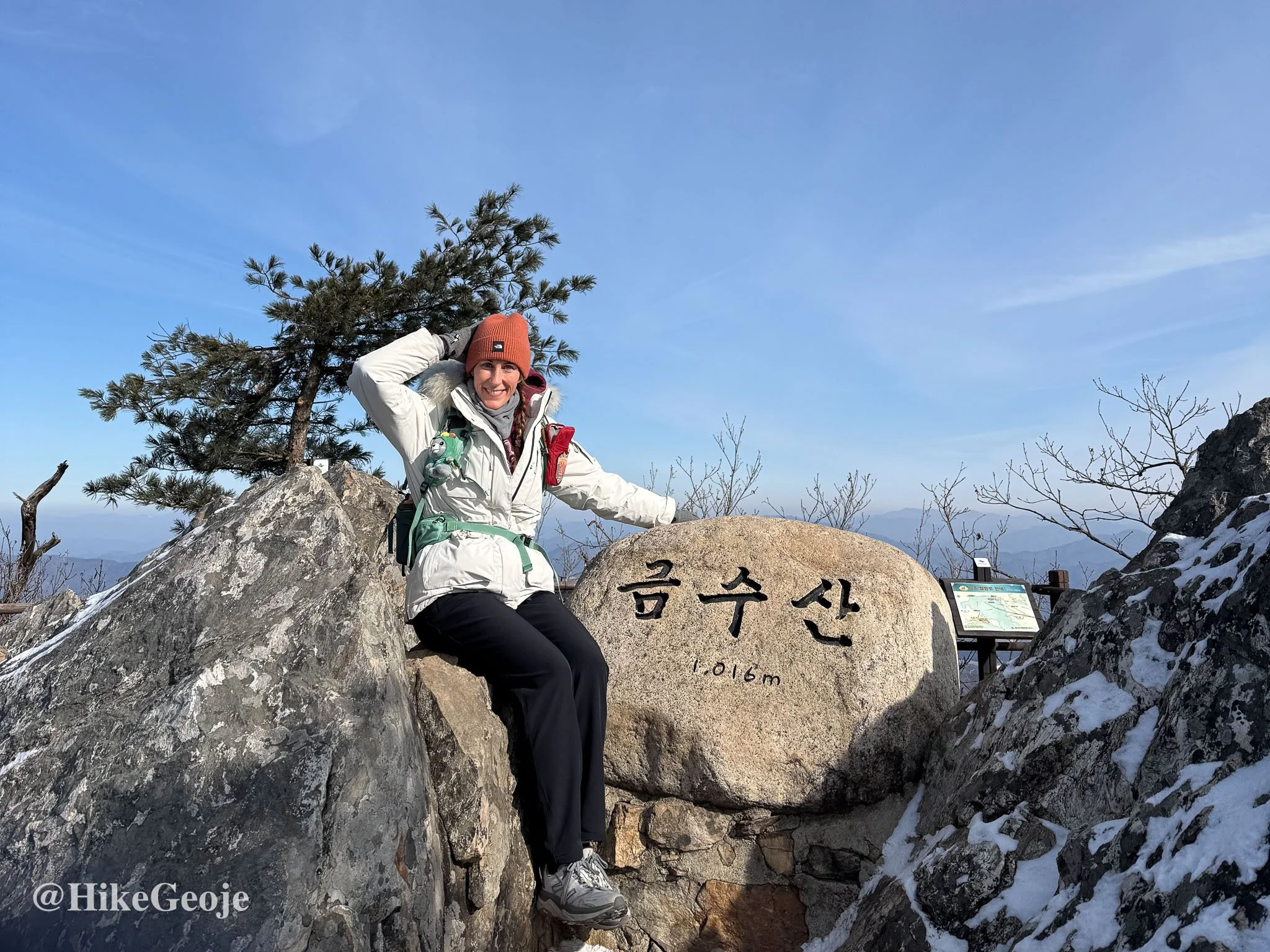
The summit stone is double sided, so I took photos from both directions before heading back down.
The Way Back Down
I had planned to make this a loop hike, but given the snow on the rocks and the unknown conditions of the alternate trail, I decided to retrace my steps. It was the safer and more comfortable option that day.
Just over two hours after starting, I was back at the car, warm again and happy to log BAC hike #29.