
dundeok Fortress 둔덕기성
woodubong 445 meters
byeolhaksan 336.1meters
approximately 2.9km to the peak
📍trailhead
I’ve recently been over to Dundeok-myeon to explore this trail twice in one week. The first time I arrived with my friend, Dan and we hiked up to the fortress and Woodubong Peak. Less than a week later, I returned with Calvin to tackle it again since the air was so clear following a typhoon. This time we explored a little further and headed over to nearby Byeolhaksan since it was on the same range.
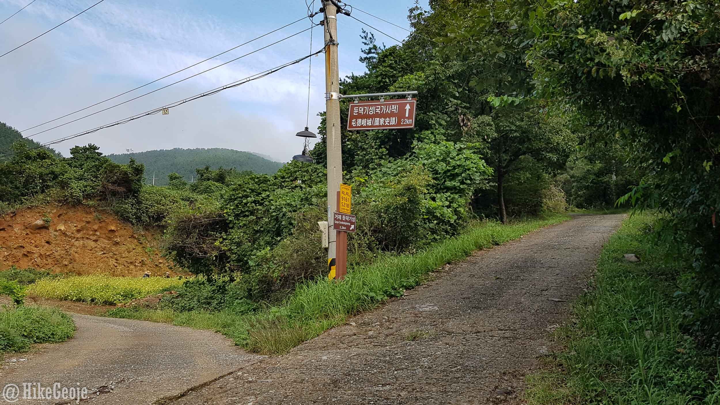
I parked at a small reservoir and started at the trailhead. Technically, I could have driven the 2.1 kilometers to the fortress but I don’t like risking getting our car dinged-up from random gravel. As it would turn out, a week later, we discovered Typhoon Mitag brought a small landslide and washed away part of the road, so it’s currently not possible to drive to the top at this time anyway.
Turn right up this way!

Eeek!
After following the access road to the top, you will arrive at Dundeok Fortress itself. You can go explore the grounds here but personally, I was more excited about the view at Woodubong that awaited, so we opted to immediately turn right at the fortress. A few more steps to the right, you will see a mostly grass-covered trail heading into the mountain. Follow this path.
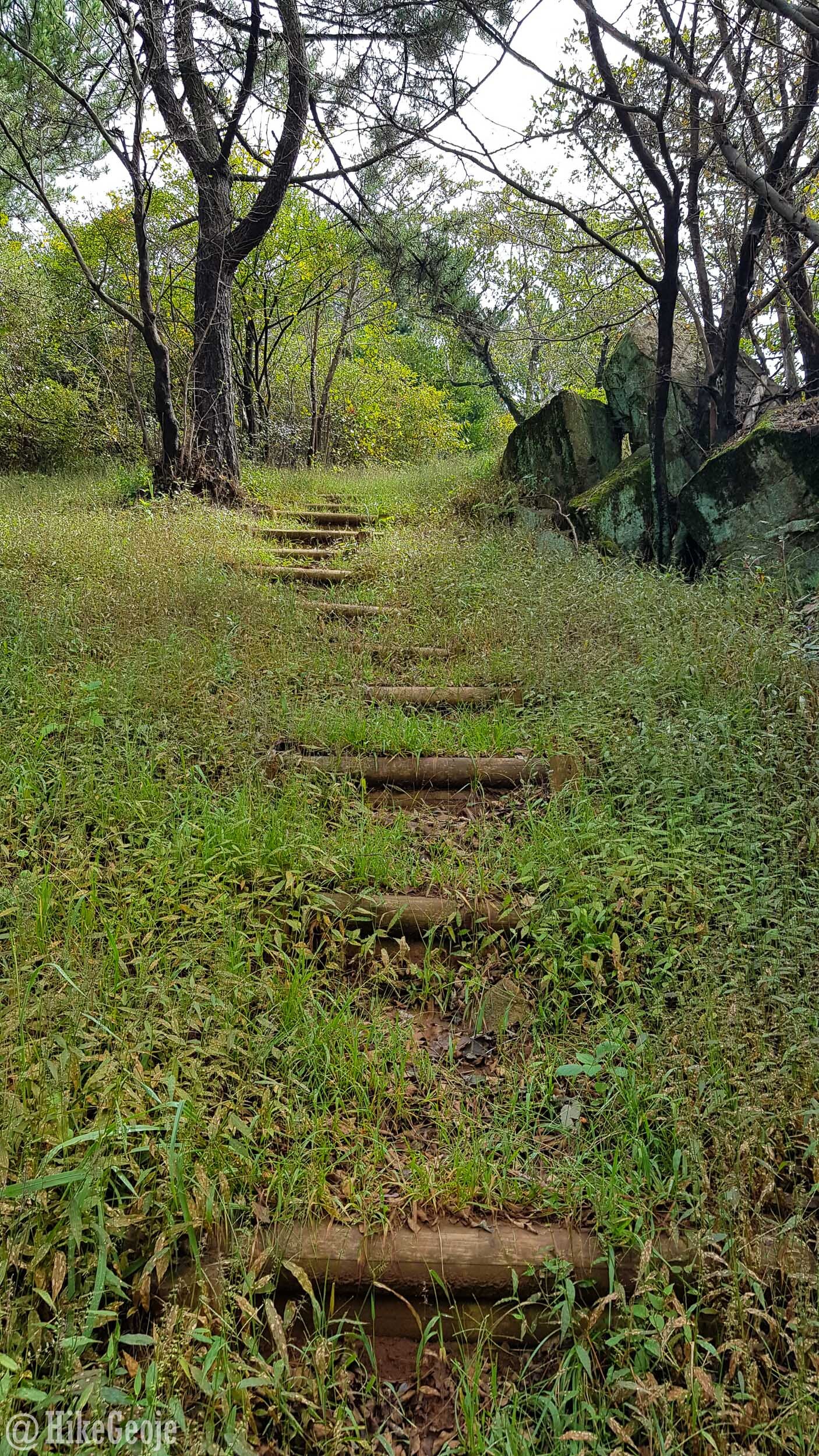
Part way up the path to Woodubong.
The trail to Woodubong is a bit steep here as well, after roughly 600 meters you’ll reach a wooden gazebo. There isn’t much of a view here, but if you need a rest it’s a good spot to stop.

One more climb for about 200 meters and you’ll arrive at the peak with an amazing view of Dundeok-myeon and beyond.
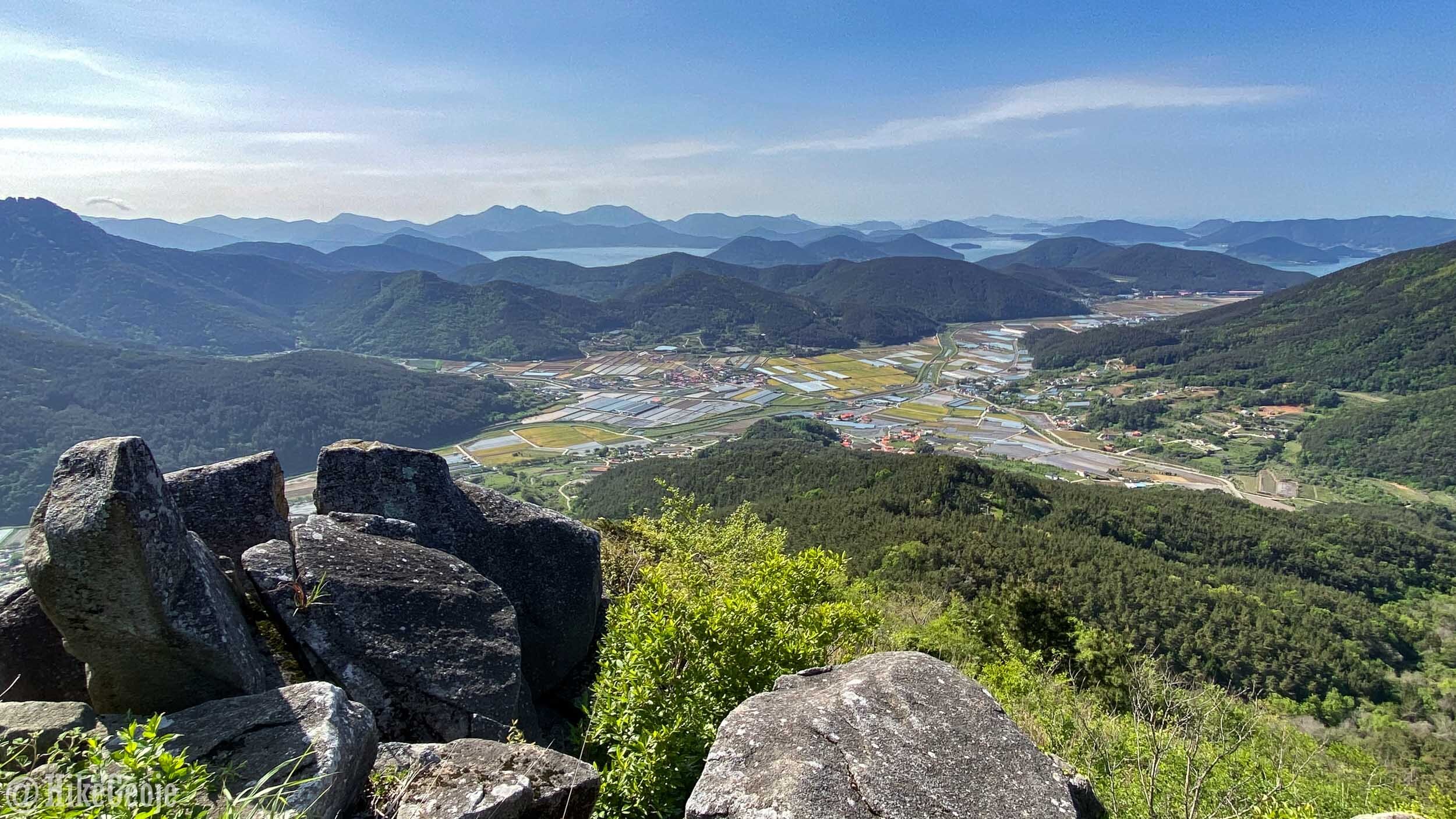

Hazy round one with Dan.
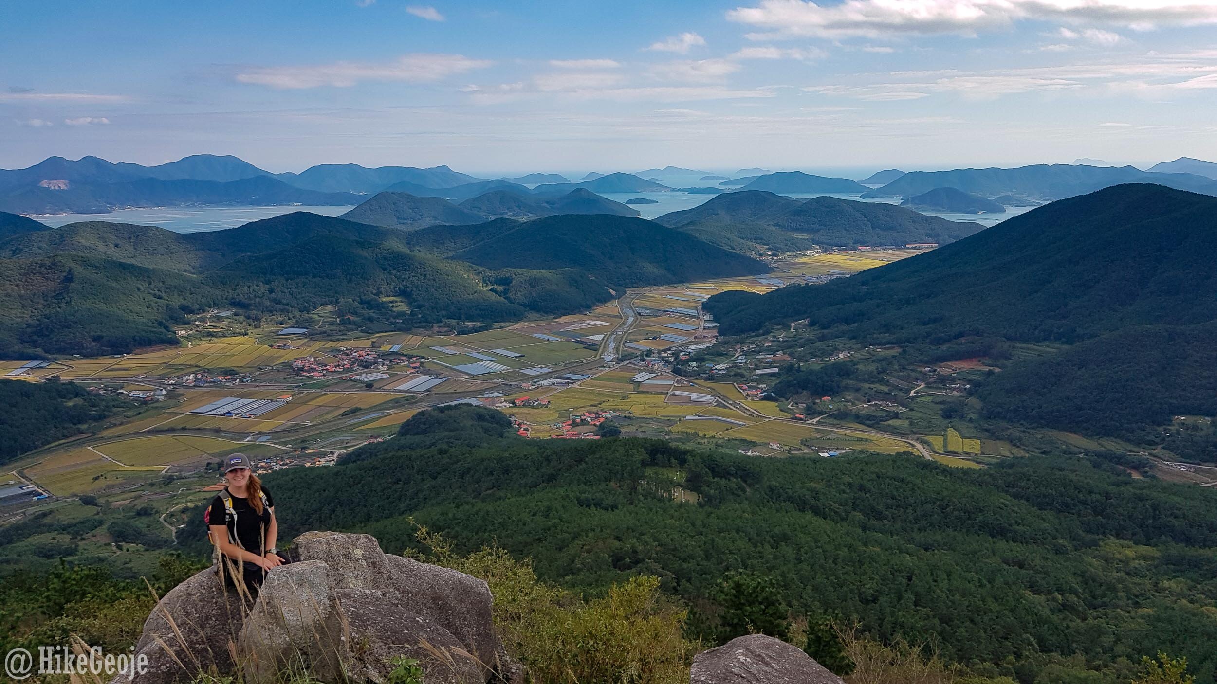
Clear skies on round two. Once again, I wore the same clothes for “continuity.” Gawd I need new hiking clothes.

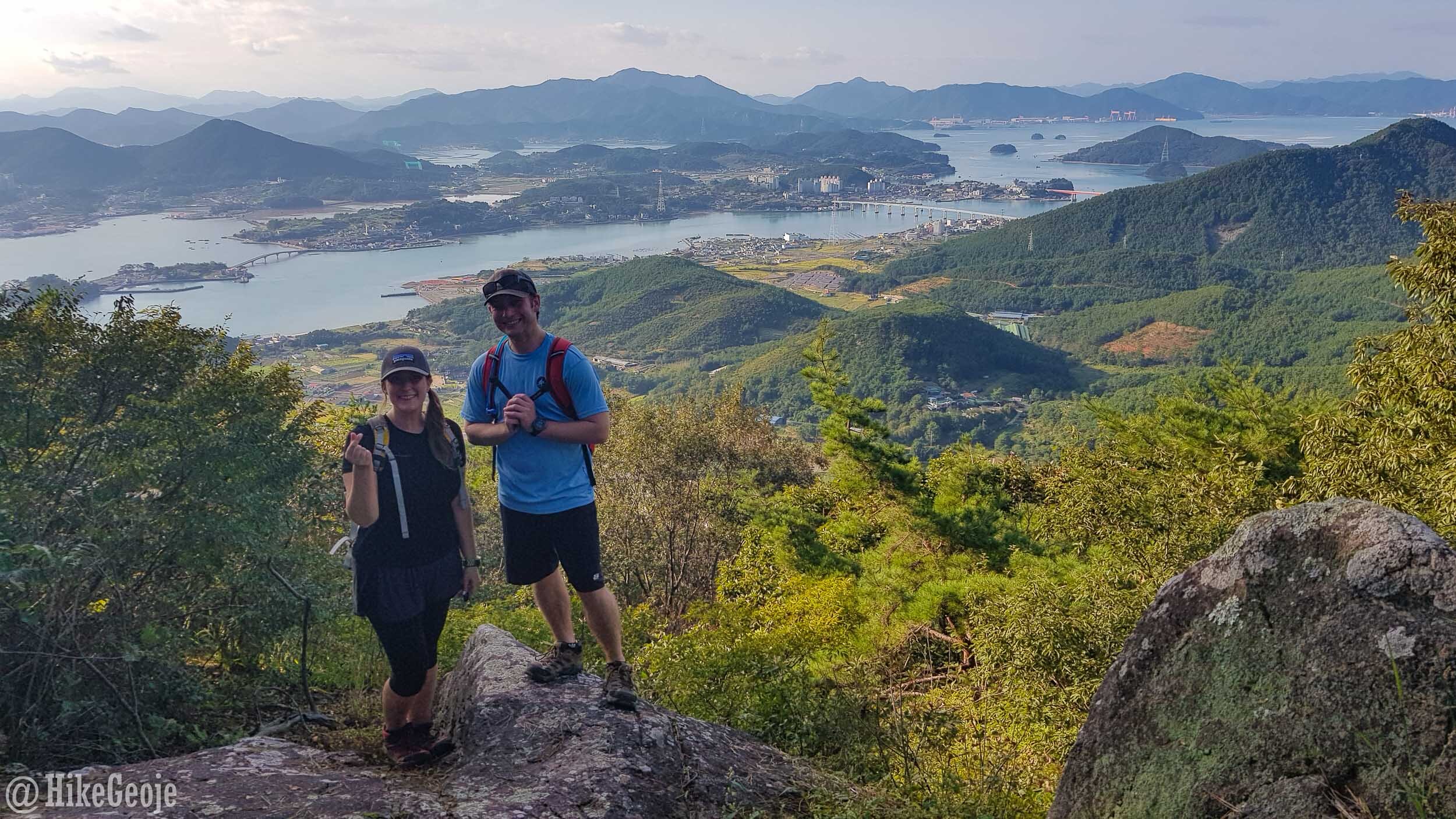
Calvin looking down on Dunkdeok Fortress and Tongyeong beyond.
Heading back down the mountain, you can check out the fortress grounds and get a nice view from the platform looking towards Tongyeong.


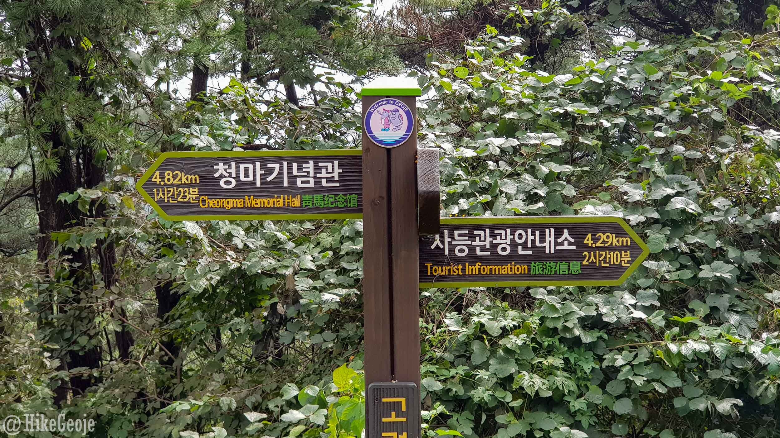
After enjoying the views, , you can simply call it a day and return to where you started. If you have more time, you might as well give Byeolhaksan a go and head over in the direction. To reach Byeolhaksan, take the road following the sign pointing towards “Tourist Infomration”.
After .87km of walking on the road, you’ll come across a set of concrete stairs leading into the mountain with a sign in Korean pointing to “안치봉등산로”. This is Anchibong Trail.


It will take roughly 1.2 kilometers before you see a sign pointing to the lookout a short distance away. The sign is in Korean and says: 전망대.

After just 50meters, you’ll arrive at the lookout that also includes a sign marker for the mountain.


Before turning back, I recommend walking just a bit further along the trail as there is another lookout with a closer view of Tongyeong.
From here, you can simply return the way you came or keep exploring. Unfortunately, we didn’t get follow the trail all the way to Anchibong Peak as it was getting late int the day and we didn’t want to get stuck on the mountain after dark. The rest of the trail will have to wait for another day.