
Dadohaehaesang national park 다도해해상 국립공원
bireonggil Trail 비렁길 18.5km+
1 course: 5km
2 course: 3.5km
3 course: 3.5km
4 course: 3.2km
5 course: 3.3km
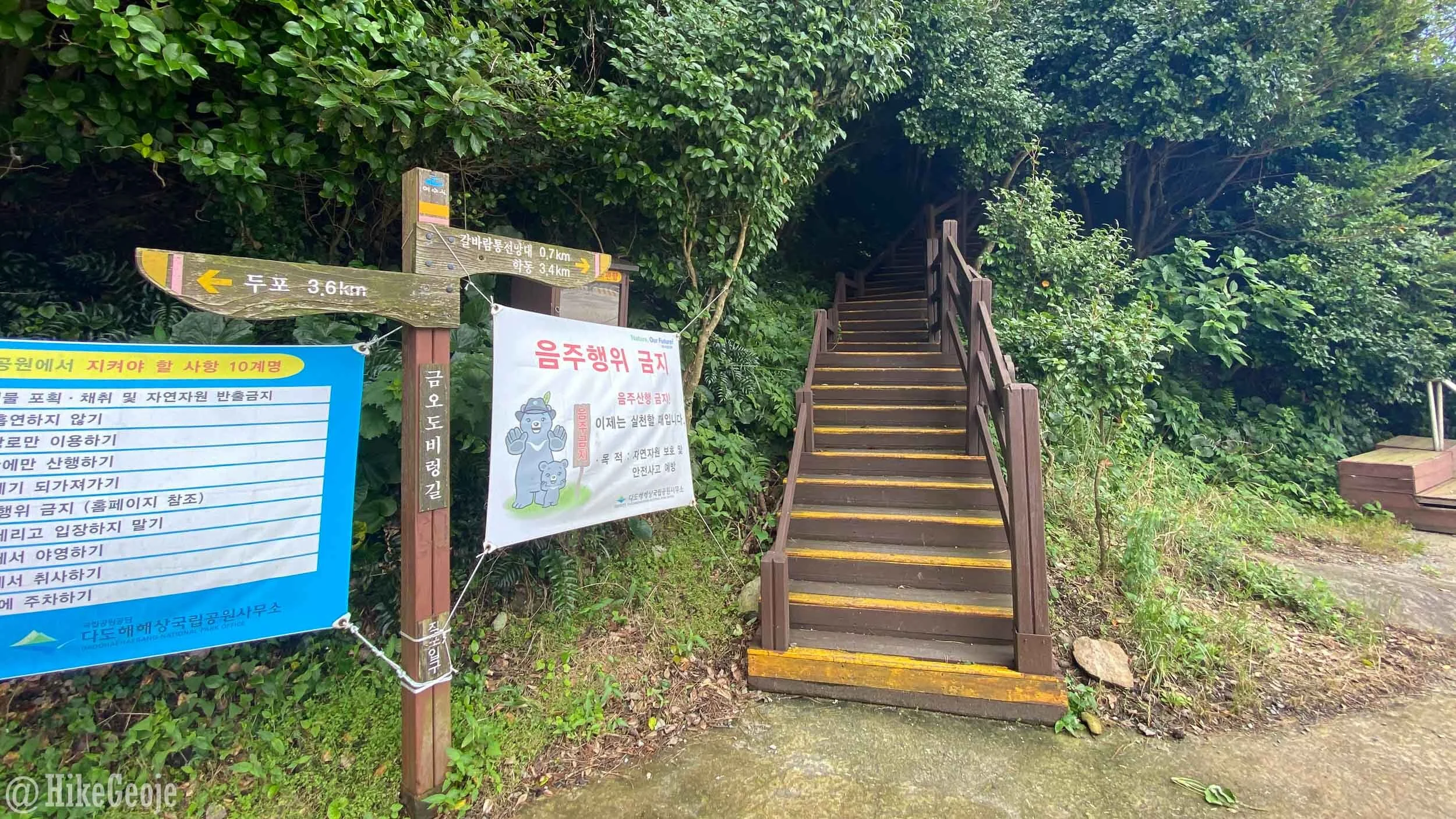
📍Trailhead
Dadohaehaesang is Korea’s largest national park. Despite covering the beautiful coastal areas in the southwest, it’s one of the lesser visited parks among foreigners it seems. I had stumbled upon some instagram pictures of the Bireonggil Trail last year and decided I needed to see it first hand.
The Bireonggil Trail is on Geumodo Island, just south of Yeosu. It’s about a 2 hour drive and a 30 minute ferry ride from Geoje. The trail itself is made up of five courses shown on the map below. The total distance for the “full course” is 18.5km, but I’ve read that it’s actually anywhere between 20.5 and 22km from different sources online when you factor in the short walks through the villages that connect each course. I’m kicking myself now for not tracking the hike through runkeeper to know for sure. With that said, if you get an early start it’s more than possible to complete all five courses in one day!

Click to enlarge.
I set off on a Friday night after work, with a reservation for a cheap motel in Yeosu. This would allow me to get to the Singi Port Ferry Terminal (신기항여객터미널) the next morning without having to wake up insanely early, yet still be there in time for the first ferry of the day. I had reservations for a campground on Geumodo for after my hike, and the campground owner kindly texted me the current (2020) ferry times which I’ll share below.


1 COURSE: 5km
After taking the ferry to the Yeocheon Port on Geumodo, I had a five kilometer drive to the start of 1 course. I parked my car and grabbed some canned coffee from a local mart before setting off in the rain to start my hike for the day. I wasn’t pleased about hiking in the rain, but I had already rescheduled this hiking trip twice before due to the rain so decided I was just going to go for it regardless. On the bright side, for the majority of the day I had the trail to myself and luckily the rain didn’t last long.

Turn right up this hill.
Overall, the Bireonggil Trail is quite easy to follow with adequate signage along the way assuming you can read a bit of Korean. It was only about twenty minutes in before I reached one of my highlights of the entire day. Even in the rain, the coastal look-off showing the path ahead (shown in the cover photo) was absolutely beautiful and I was so excited to continue on and see the rest of the trail.


On the walkway.

Looking back.
Soon after, you’ll emerge on some country backroads before making your way along a narrow concrete road. This road was where I saw two huge snakes just about ten meters from each other. The snakes were Korean pit vipers called Mamushi, or 살무사 in Korean. They are venomous snakes, but it wouldn’t be enough to kill an adult human. I imagine their bite could still do a lot of damage though. I have heard talk of dogs that have been bitten and died on Geoje due to Mamushi bites.


I was lucky to have had my phone out to capture a short video of the second snake. To be honest, I was definitely scared for the remainder of the day because there were several sections of trail where it’s grown over with grass and you can’t really see where you’d be stepping. Even so, I was a tad more excited about seeing the snakes because I was able to get video of one and I don’t think anyone would have believed me when I said how big they were! Check out the video to see for yourself!
After the concrete “snake section” you’ll come to a small restaurant that looks as though it would have been a great spot to stop and eat, had I not already had breakfast. Walk past the restaurant and go right heading towards what looks to be a house or pension. When you reach the house, turn right and go up the hill back on the trail.

I did enjoy my pajeon later on in the day, but I think this was the best looking restaurant along the trail. I wish I had been hungry at this point.

Go right here.

And another right.
Along this section of trail, you’ll reach a t-junction, follow the trail to the right. Continue along and you’ll reach one more fork in the path. When I was there, someone had kindly tried to block the trail to the left, but in case it isn’t blocked in the future, stay to the right again.


You’ll have one more ocean look-off on 1 course before reaching a small bamboo forest which is at the end of the this section of trail. You’ll emerge next to some trail bathrooms and a little village. Just like that the first 5km are finished!


2 COURSE: 3.5km
Walk through the small village and cross the bridge on the right. From there, the trail will start on an old concrete road going up a hill on the left. You’ll actually be walking on this old roadway for a while, but easy terrain makes for fast going!


You’ll pass a house along the way. For my hike, there were several barking dogs there. Most were leashed, but the one that wasn’t didn’t try to follow me despite all of them barking at me. Walking past the house, you’ll see a set of stairs on the right, this will take you to an ocean look-off. It’s only a few extra steps so I suggest checking it out.

The main trail is on the left, but don’t miss the look-off down the stairs to the right!

The look-off.
Returning to the top of the steps, this time take the trail on the left side of the old shack. You’ll walk past some very old concrete buildings and then the trail will veer to the right through the overgrown grass.
Once back on the trail, the path rolls along and it’s not too steep. You’ll have a few openings in the trees that look out to the ocean and you can see the village ahead. This section of trail has another ocean viewing platform to enjoy the sea views before making your way to the next village.


3 Course: 3.5km
After 8.5km of hiking, I decided it was time for lunch and treated myself to a beer and pajeon before getting back on the trail. While I waited for my pajeon, I showed the video of the snake to the restaurant owner, half expecting her to call the local news station because the snake I saw was so big. Instead she kind of shrugged and said, “yes, there are many snakes on 3 course”. I explained that the video was on 1 course, and I had seen another snake (the third and final of the day) on 2 course. She simply replied to be careful on 3 course because there are many snakes.
At this point, I kind of considered ordering another beer and just calling it a day as I was worried a bit about the snakes. One big beer was enough though to give me the liquid courage to carry on. No snake was messing with my hiking plans!

Walk to the far end of the village and you will see the beginning of 3 course heading up some stairs into the woods.
This course has a bit more climbing than the previous courses, but nonetheless was worth the effort. The trail is very easy to follow with several viewpoints along the way and wooden platforms along the ocean!


I was so excited to see the next small platform area, as I had seen photos of it on Instagram quite a bit. I had planned on getting some drone shots overhead, but it was just too windy. I was thankful for the day’s weather starting to clear up a bit though, even if just temporarily!


4 COURSE: 3.2km
I’ve heard that most people only complete the first three courses and to be honest, I can understand why. At this point, you’ll have hiked 12km as well as the “between courses” distance which is more than respectable. The highlights of the entire trail were on the first and third courses in my opinion. Nonetheless, I didn’t want to feel any regret on missing the last two courses so I decided to carry on.
The next village is a pretty small one to walk through and there weren’t any restaurants there. Keep heading through the village and walk past the bathrooms on the rocky shore before re-entering the trail.

This course is similar to the previous ones in terms of terrain. Basically a soft path that hugged the coast, but was mostly blocked from the the view with the exception of a few nice wooden platforms along the way.


Sidenote: At this point, my phone was dying so I was trying to hike faster than the battery drained, but was still able to snap a few pics along the way.
5 course: 3.3km
The connecting village here was the biggest connecting distance (probably about 1.5km), so it didn’t really help that I was kind of “over-it” and tired out by the end of the third course. Nonetheless, I pushed through but I was seriously ready to be done and back at the campground; showered, having a beer and grilling.
Like the connection between the second and third courses, you will follow an old concrete road up a hill on the left and walk on that until it turns to dirt. Keep going and soon enough you’ll be back in the woods and on a forested path.

To the left, to the left…
You’ll have another ocean platform or two and views of the village where the course finally ends.

Although the 5 courses weren’t terribly strenuous, it was still a long day and I had to talk myself into continuing for the final two courses. I was so happy to have finished it in full, that I had to snap a selfie at the end of the trail with the “5 course” sign.

From here, I walked into the village and luckily found a lady doing some gardening outside of her pension. She kindly called a local taxi van for me to drive me back to my car at the beginning. Although the taxi ran on the meter, you should still expect “island prices”. It was either 30,000 or 40,000 won (I can’t remember which) for the 15ish kilometer ride back to the start. Keep in mind though, most people aren’t doing this as a solo hike so it wouldn’t seem as much for one person or even sharing with other hikers who finished around the same time.
Back at the campground I was so incredibly happy for a nice cold shower, a few beers, and my fried spam, haha!

I was too wiped out to try and get some nice insta-worthy camping photos, but the next morning I was treated to a pretty incredible sunrise from my tent and managed to snap a pic of that capping the end of my adventure on Geumodo.
